


Prior post: http://blog.bucksvsbytes.com/2021/07/30/road-trip-21-06-19-arctic-weather-forecast-changes-our-route/
[NOTE: To enlarge any image, right click it and choose “Open image in New Tab” or similar.
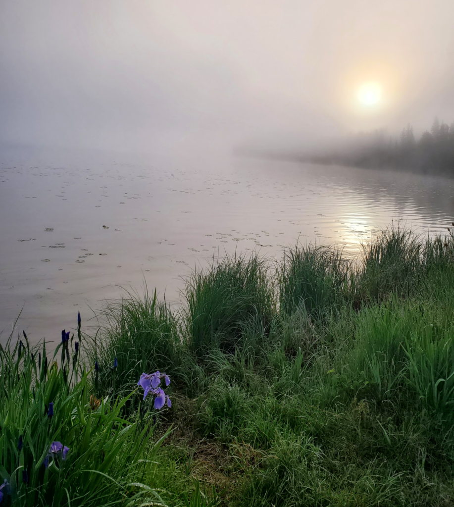
Thanks to the sun merely dipping below the northern horizon, last night’s Birch Lake sunset has morphed into an equally beautiful sunrise. Our roadside snooze was only 5 hours long. In Alaska, no one sleeps much during the long summer days, which is not to say that doesn’t take its toll on the body.
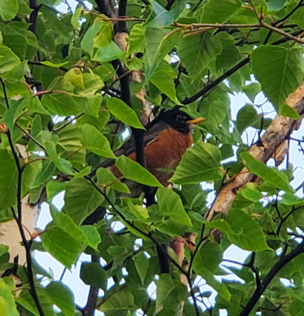
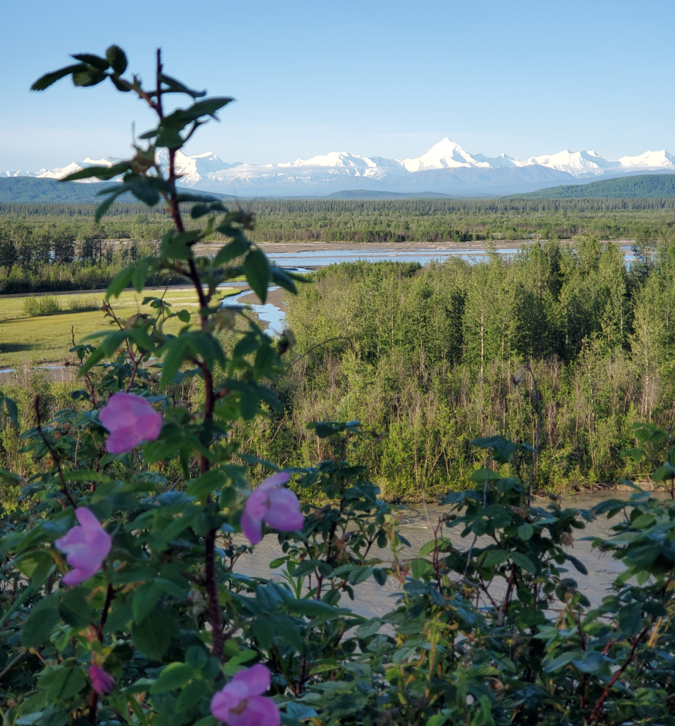
As we crawl out of the van, we’re greeted by the cheerful song of an Alaska robin…
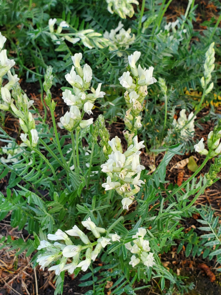
…and a patch of blooming wildflowers.
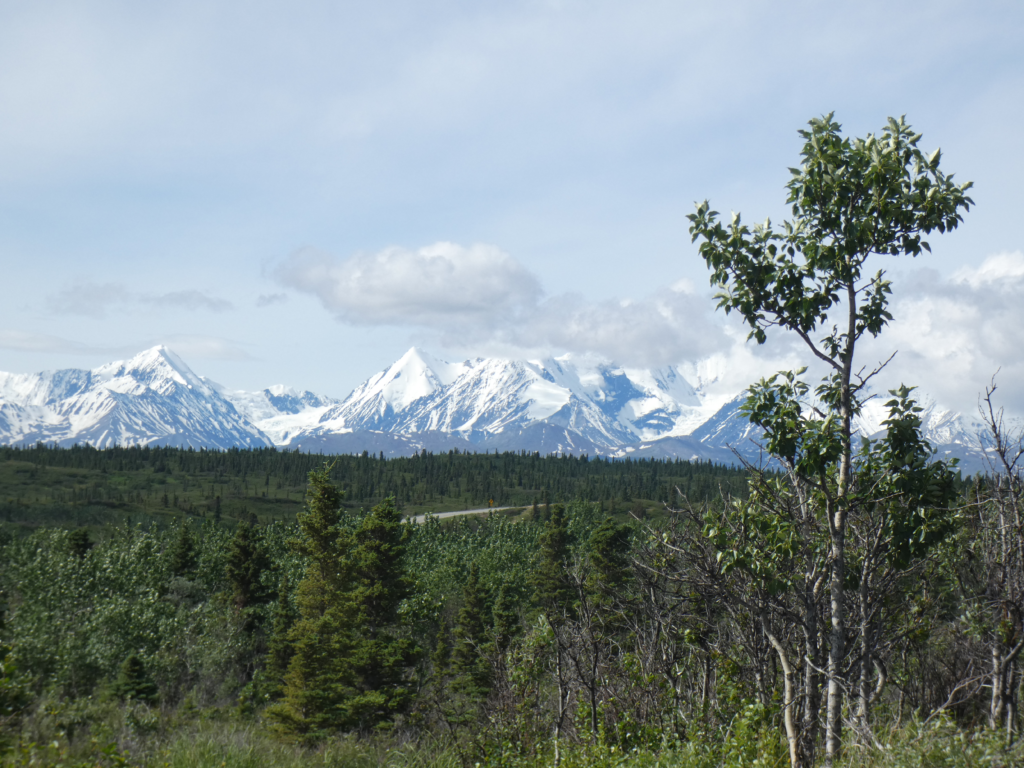
As we resume driving, the road converges again with the Tanana River, affording us a view to the south of the Alaska Range. 20,000 foot Mt Denali lies 200 miles to the west along the arcing spine of the range but we’re seeing more “modest” peaks, rising only to about 12,000 feet. We plan to cross those mountains through a low pass later today.
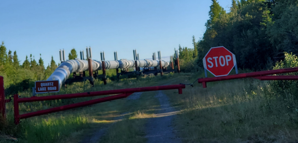
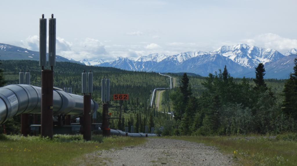
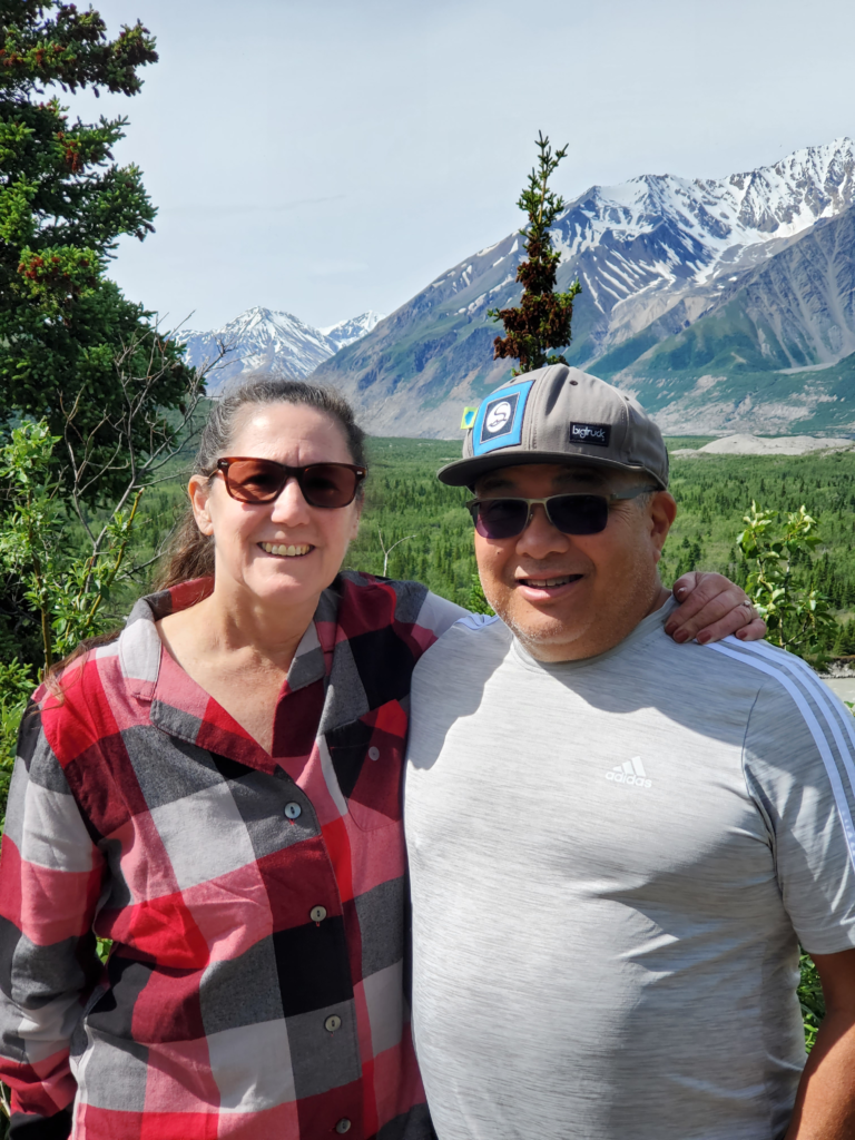
Dawdling along down the Richardson Highway, we take the time to explore a side road to Quartz Lake. Here, Susan gets the first of many views to come of the Trans Alaska Pipeline, which has been paralleling our route between Fairbanks and Valdez, its terminus.
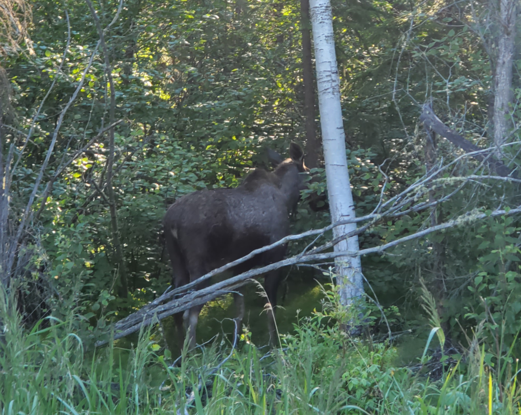
She also gets her first glimpse of an Alaska moose as it slips into the forest at our approach.
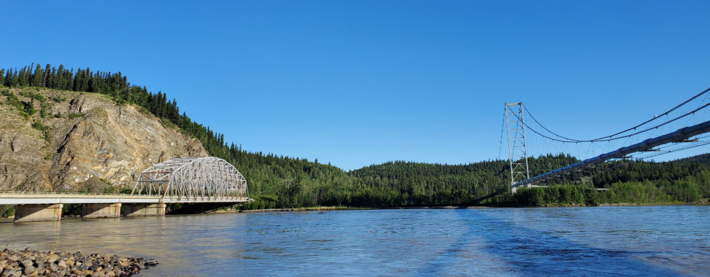
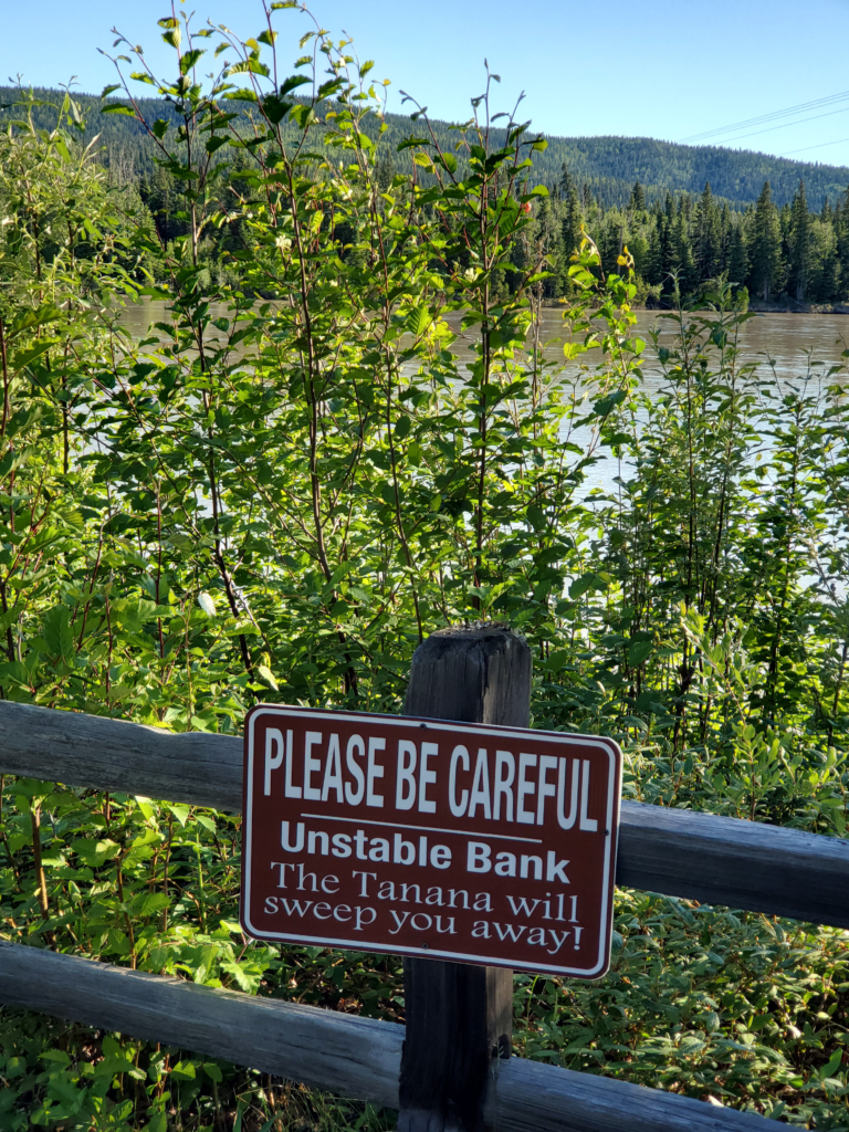
Shortly thereafter, we reach the big bridge across the Tanana River with its adjacent span carrying the pipeline across.
The Tanana is high volume, swiftly flowing, opaquely silty, and very cold thanks to its glacial meltwater origins. Standing too close to the water is likely fatal if the mudbank under your feet should collapse at the wrong moment. I’m always conscious of that in this situation and I explain the danger to Susan, too.
The Richardson Highway was the first route suitable for wagons, and then trucks, to bring goods into interior Alaska from ocean ports. It started out as 400 mile pack trail to the gold fields in Eagle, Alaska and by 1910 the US Army upgraded it to a wagon road connecting Valdez and Fairbanks, Because the trip was slow and arduous at first, a substantial number of roadhouses were established to supply food and shelter on the long journey.
One of these is Rika’s Roadhouse, preserved in the Big Delta State Historical Park here along the shoreline. Until the first bridge across the Tanana River was built in the 1940s, the Richardson Highway required a ferry crossing here, making the riverbank a lucrative place for a roadhouse. Rika Wallen was the last operator and when Rika’s closed around 1950, she continued to live there until her death in 1969. Due to the short time span, the property was relatively easy to preserve and restore as an historical attraction ten years later.
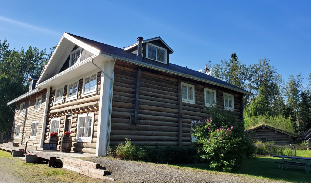
Today, you can tour buildings, grounds, and artifacts in an environment somewhat similar to the active roadhouse days. We’re here early in the morning, so the buildings are closed and the park deserted, but walking the grounds and reading the interpretive signs, you can really imagine how it was.
An interesting episode occurred starting in 1935. The only competing route to Fairbanks was the federal railroad from Seward. By that year, trucking up the Richardson was substantially faster and cheaper, so the railroad was losing a lot of money. To compensate, the feds instituted fees per ton for the highway. Truckers refused to pay, so the fees were collected as the ferry fare. This caused the truckers to use the ferry without permission. After some years of this, a US Marshal traveled to the Tanana in 1940 and arrested 14 men. While they were in court, other truckers took away the shotgun of the marshal left to guard the ferry, locked him in the scale house, and transferred 10 loads of cargo across the river. When done, they released the marshal and his firearm. The sympathies of Fairbanksans were clearly on the side of the truckers — a grand jury refused to indict the marshal’s captors and a trial jury found the first 14 truckers not guilty. In 1941, the truckers built and operated their own “pirate” ferry to avoid the tolls. The government then built a toll gate 12 miles north of the river to collect tolls there. Truckers pulled down the gate! Some of that same renegade spirit is still evident today.
As the highway improved, cutting the travel time to Fairbanks from nine days or more to just two, most of the roadhouses were no longer needed and went out of business or tried to cater to tourists.
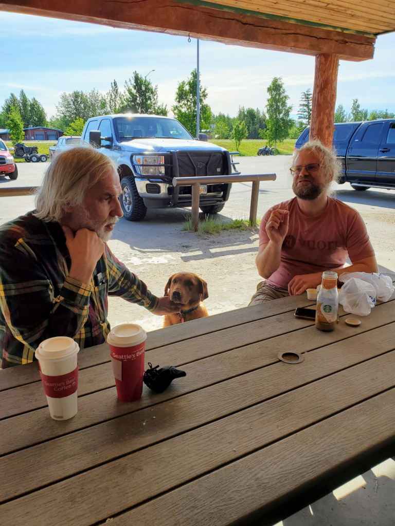
Leaving Rika’s, we’re really getting hungry so we stop at the IGA market in Delta Junction and find good pastries for sale at their coffee counter. While eating at their outdoor picnic table, we strike up a conversation with another coffee drinker who turns out to be a Swiss glaciologist who’s spent years in Alaska researching the mechanics of glacial flow. Almost everyone you encounter in Alaska has an interesting story of some sort.
So far we’ve been heading toward the Canadian border, but now we turn due south toward Valdez. This is one of my favorite Alaska highways (the state only has about a dozen major ones) and I drove it many times in the old days. We’ve been paralleling the Alaska Range but now we head straight for it. Shortly after the turnoff, we pass Fort Greely. Founded in 1942 shortly after completion of the Alcan Highway, its airfield was one of a series along that road used to shuttle military aircraft and supplies to the far east of the Soviet Union (USSR). The Russians were our allies against the German and Japanese in World War II.
With the war over and the Cold War with the USSR taking shape, the military understood that it was vital to develop cold weather combat capability. Situated in one of coldest, road-accessible areas in wintertime Alaska, Fort Greely was designated in 1946 as the center for testing polar combat techniques and equipment. This testing and training continues through the present day. Now, it may come to prominence again as a site for the new generation of missile interceptor missiles designed to counter North Korea’s advancing ballistic missile technology.
We can’t visit the base of course so we pass the entrance on our left, heading up the broad, glacial Delta River valley. The Trans Alaska Pipeline is frequently in view from the highway and crosses it periodically.
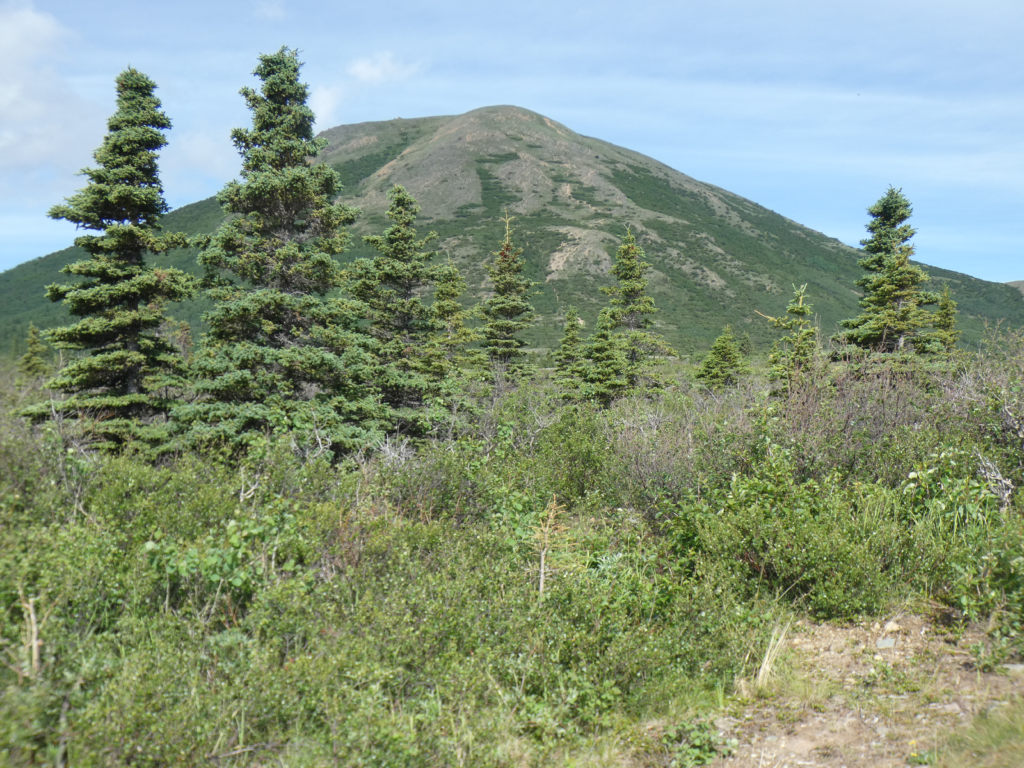
With the distant snow capped Alaska Range becoming more dramatic as we approach, we pass Donnelly Dome, a free standing hill along the highway. This was the scene of a memorable, actually notorious, 1976 camping trip. After driving 300 miles from Anchorage to camp for the weekend without facilities, we discovered I had packed everything we needed — except the sleeping bags. We had a very makeshift couple of nights staying warm in the tent and I never lived down the embarrassment.
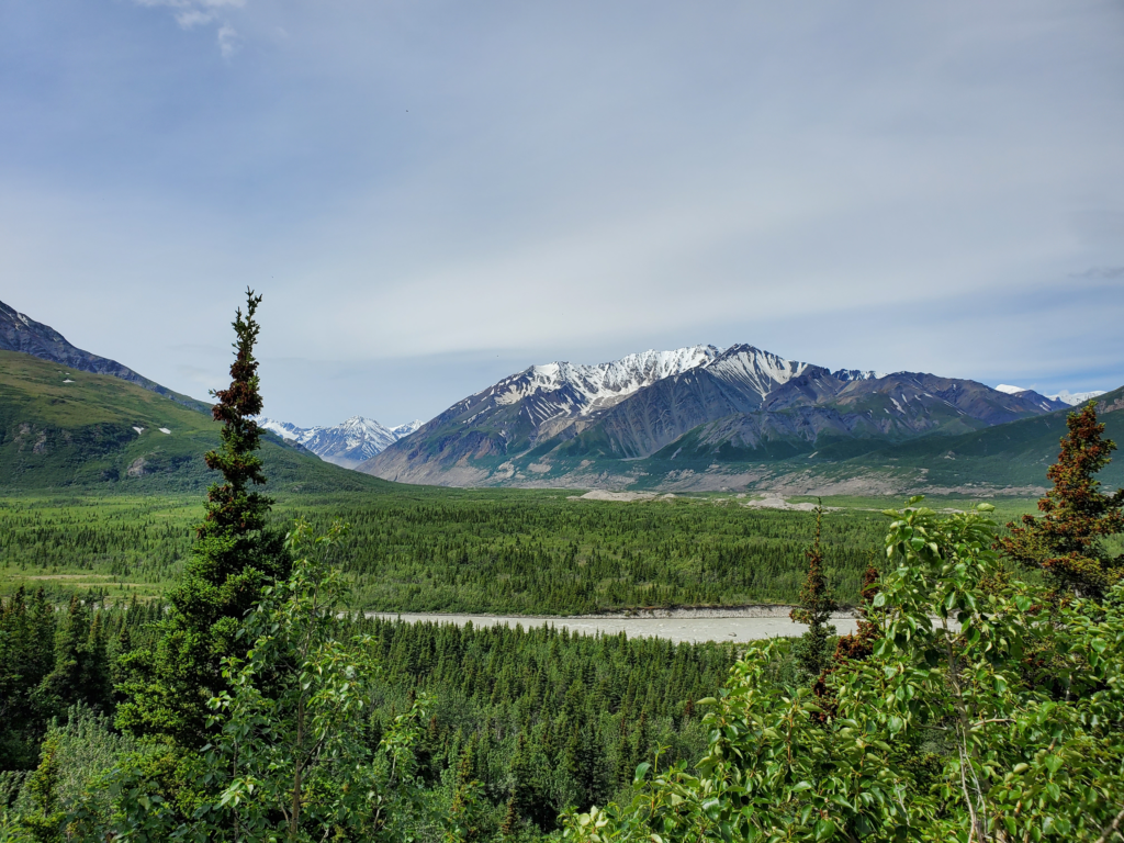
At one pullout, formerly (for reasons I’m about to explain) signed as “Black Rapids Glacier” we turn off to a view eastward across the broad north-south Delta valley to an almost as broad one issuing westward out of the mountains. This valley was formerly filled by the Black Rapids Glacier, a surge-type that periodically moves up to 100 times faster than its normal “glacial” (get it?) pace. In 1936-37, it moved so fast that it garnered the nickname the Galloping Glacier and there were fears it might advance far enough to dam the Delta River and flood the main valley to the south causing substantial disruption. In my Alaska days, it was no longer advancing but was very prominent from this viewpoint.
For those unfamiliar with glacial dynamics, some explanation might be of interest. At any rate, interested or not, you’re getting it: All glaciers are rivers of ice. They flow down hill at very slow speeds, similar to water rivers but thousands or millions of times more slowly. If a glacier goes over a rock cliff, it forms an icefall instead of a waterfall. If its valley turns a corner, a circular flow may form, just as an eddy can form at a river bend.
A big difference between glaciers and rivers is the type of landscape they create. A river, relative to its valley, is basically a thin thread. Flowing water is a powerfully erosive force so it carves its valley more or less vertically downward in a single line. Rivers form V-shaped valleys. I’ll skip explaining why they’re usually Vs instead of simple vertical canyons.
A glacier, by contrast, fills its valley with ice. As it flows downhill that massive, slow moving mass grinds away at the sides and bottom of its valley, picking up gravel and plucking giant rocks from the bedrock. This material gives the glacier even more erosive power.
Glaciers carve large U-shaped valleys because they’re very efficient at quickly scouring large amounts of rock simultaneously from both sides and the bottom of the valley.
So if all glaciers flow downhill, what is this talk of “glacial retreat”? It’s simple to understand once you realize that what’s retreating is the face of the glacier, not the glacier itself. Near the top, where snowfall is heavy and temperatures average well below 32 F, far more ice forms than melts every year. The weight of this ice forces the glacier to flow downhill.
But every glacier, even those in Antarctica, eventually gets down to an elevation where the weather is warm enough to melt more ice than arrives from uphill. At any given time there’s a point where exactly as much ice is melting as is arriving from above. That is where the face of the glacier forms. If conditions don’t change, the glacier is still flowing downhill but the face stays right where it is.
Now, suppose the average weather along the glacier is warming over the years, as we’ve been seeing in many parts of the world since the Industrial Revolution. Warmer weather down low can dramatically increase melting. If the weather up top does not supply additional ice, or supplies less than before, the lower glacier melts faster than can be replaced and the face retreats up the valley. — even though the ice is always moving downhill.
If the weather warms enough so the face retreats to the very top of the glacier, poof — no more glacier!
Black Rapids glacier could some day start surging again, but the warming climate would likely offset that surge with increased melting. Since I last saw it in 1983, the face of the glacier has receded several miles up from the valley mouth and around a bend and is no longer visible at all from the road.
OK. End of lecture.
At the viewpoint, we meet a couple where the husband is an Alaska Native and the wife a Floridian. They flew up on vacation and are paying the horrific rental rate on one of the new RVs I saw being shuttled up the Alaska Highway a week ago. It’s their only option, since rental cars are in very short supply, and thus very expensive, after companies sold off much of their fleets during the Covid lockdowns. It makes me very glad I managed to get my van up here through Canada despite the border closure.
We’re now approaching Isabel Pass through the Alaska Range. Although the pass is at a modest 3,300 feet elevation, the road runs above treeline for about 80 miles. This far north, 1000 feet of elevation yields a substantially different climate. Frigid temperatures, drifting snow, and isolation can make this stretch of highway particularly dangerous in winter despite heroic levels of plowing.
On the other side of the pass are Summit and Paxson Lakes, popular summer boating and winter snowmachining recreation areas.
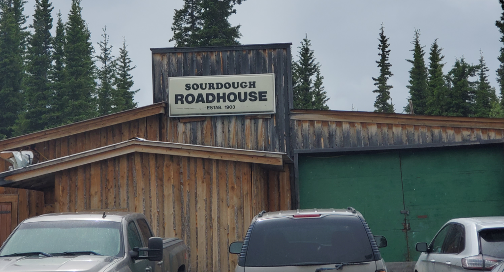
Finally, we descend back below treeline as we drop down toward the Gakona River. Here we pass one of my favorite roadside stops, the historic Sourdough Roadhouse. When I lived in Alaska, they offered all you can eat sourdough pancakes, all day long. This is where I learned to appreciate sourdough cookery. On several occasions I drove up to 70 miles out of my way to chow down at the roadhouse. Forty years later, to my disappointment, although the “Sourdough Roadhouse” sign is still displayed, the building is clearly a private residence.
A further 30 minutes brings us to the small junction town of Glenallen, where we can turn right for Anchorage — not today — or straight on to Valdez, which is a 120 mile dead end unless you put your vehicle on an Alaska Marine Highway ferry. Susan finds a Thai restaurant in Glenallen and that means a mandatory stop for Thai iced coffee. I don’t get why it’s so special, except for the high price, because it seems to just be coffee, evaporated milk, and sugar. I can do that at home but Susan is surprised and happy to have found it in rural Alaska. We’ll be coming through here numerous times this summer and I joke that she’ll be recognized as a regular and just order “the usual”.
We start down the road toward Valdez, but first I have a special side trip in mind. 90 miles to the east of the highway lies McCarthy, a tiny town adjacent to the immense but long abandoned Kennecott Copper Mine. For reasons I’ll explain in the next post, I never visited McCarthy when I lived in Alaska. This is my chance.
The first step is to drive the Edgerton Highway, 33 miles of now modern road that ends in Chitina, a native village and former railroad town. We turn off the Richardson Highway and proceed east. The first portion is the original alignment which has been bypassed by a newer paved road. It’s raining rather heavily, so the unpaved version we’re on is quite muddy but not a problem with careful driving. Rejoining the paved version, we move along uneventfully through typical forest terrain. We should be seeing views of the very dramatic Wrangell Mountains to the north, but the rainy weather precludes those.
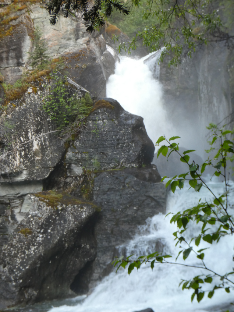
Although we’ve only covered 260 miles today, we’ve dawdled and gawked and been distracted by the wildly varied scenery, so it’s time to sleep for a while. Just when we decide that, we happen on Liberty Falls campground. It’s namesake falls are gushing out of a bedrock slot, dropping about 20 feet with the flow divided in two by a large outcrop that hasn’t yet succumbed to the falls’ erosive power. It’s very picturesque and powerful so we wander around to various perspectives and appreciate the scene. There’s a campground here but since we’re sleeping in the van there isn’t much point to paying the fee.
After an hour or so, we proceed a few miles along the highway and find a secluded road stub that gets us out of sight of the pavement. Here we work quickly to get ready to sleep, but still allowing a hundred or so mosquitoes to join us by the time the doors close for the night. The first half hour is spent watching and listening for the little buggers so we can slap them down before being bitten all night long. Success largely achieved, we get some rest, waking only occasionally when the dread hum of a remaining mosquito buzzing our eardrum strikes momentary terror and foul language as a further effort to squash the intruder ensues.
Next post: https://blog.bucksvsbytes.com/2021/08/06/road-trip-21-06-21-the-mccarthy-road-former-railroad-track/