This is the log of the first 42 days of Susan’s and my Chile+ road trip, Part 2, heading north from Santiago in our well worn 2006 Chilean Subaru. Unfortunately, I haven’t gotten it together to add photos, so words will have to do.
Day 1, Wed 17 Oct: We arrive in Santiago after a long redeye flight from JFK via Buenos Aires. We take an Uber over to Brian’s apartment tower to retrieve the car stored there. Everything is shipshape and after reinstalling the rooftop cargo pod and chatting with Brian and Pablo awhile, we head over to our hosts, stopping along the way for ceviche at a Peruvian restaurant. Susan has a Pisco sour and by the end of lunch, she’s talking about an open ended trip rather than a fixed return date. It seems a daily cocktail is a good investment in trip longevity. We arrive at the Nuñoa apartment of Alberto, Isabel, and Almendra with whom I stayed last month. They are a great, lively family who generously offer hospitality despite their busy schedules. An added bonus is their mastery of English which makes conversation easy for Susan and easier for me. We’ve had a looong flying day, so we quickly crash on their comfortable drop down living room couch.
Day 2, Thu 18 Oct: We set out in the late morning to get Bolivian tourist visas, very expensive at $160 dollars per person. They are allegedly available at the border, but I don’t want to take chances on bureaucratic hassles at some remote frontier outpost. After getting id photos made at a local copy shop, we catch a train (wrong train in the wrong direction on my first try) at the Ñuble Metro station and walk up to the embassy about 1 PM, prepared for the possibility of waiting out their lunch break. We’re are not prepared, though, to see their engraved metal sign that says “Service Hours 8:00-12:30”. It hadn’t occurred to me they might close that early, so it looks like a wasted trip. Susan checks online and sees Google indicating additional afternoon hours, but I’m skeptical because the sign on the gate seems like it would be authoritative. Nonetheless, we decide to kill some time downtown and return at 4 PM in the hope of salvaging the foray. Sure enough, at the appointed time, there is a small line of Bolivians waiting for access and we are soon in front of the consular officer. On hearing that we are US citizens, he says that getting visas at the border is straightforward. To get one at the embassy, we first have to fill out online forms and bring back printed copies. We resolve to do this the next day to eliminate uncertainty. Heading back home, we run into another unexpected problem, Susan’s Metro fare card needs replenishing. The last time I did this, you could pay cash at a booth in any station or use a credit card at vending machines. Now, things have been “modernized” into impossibility — international credit cards appear to be uniformly rejected, there’s no more fare booth, my 10,000 peso bill is too large for the machines to handle, and no vendor in the station will give me change. After wasting over an hour figuring this all out, we end up buying a drink at KFC (!) just to get the smaller notes we need and finally ride home. The new Line 6, recently opened, has a feature rarely seen in subway systems — a glass wall extends the entire length of the platform, so no one can possibly fall, jump, or be pushed onto the track. When the train arrives, its doors sync up with those on the platform and they both open simultaneously — very slick. Back at the apartment, we walk a couple of blocks to the supermarket and get supplies so I can cook dinner for everyone. The Villa Olimpica development was built to provide housing for tourists attending the 1962 World Cup nearby. Subsequently, it became middle class housing and has a recreational area in the center. We found it full of teenagers, parents with children, and older people. As is frequently the case in Chile, every available blank wall is covered with murals, many of them political. Susan took photos of many of them since they add so much to the neighborhood.
I make killer spaghetti sauce and garlic bread for an excellent late meal when Isabel, who runs a library during the day and goes to school in the evening, gets home. Dessert is cream filled pastries from the nearby Venezuelan bakery. In general, I keep my expectations for baked goods in South America quite low since I’ve had a lot of very mediocre experiences in all of the countries there I’ve visited. Even some items that have looked delicious were disappointing. In this case, the baguettes and pastries were excellent, though, and added a lot to the meal. Stuffed to the gills with good food and great conversation, we’re ready to crash after dinner at about midnight.
Day 3, Fri 19 Oct: I spend most of today working, but at about 1 PM I start filling out the online Bolivian forms. They turn out to be complex and time consuming, with numerous required data, photographs, and uploads. Try as I might, I’ve started too late to get them completed and printed in time to deliver them to the embassy by 4:30 PM so reluctantly we’re forced to leave it until we eventually reach the border.
Isabel’s father, Ricardo, happens to be a poet so naturally he and Susan have to meet. Isabel invites her family for tonight and we buy a so called “Thousand Leaves” creamy cake to contribute toward dinner. On our short walk to the bakery, we notice that all the murals have been painted out overnight and several artists are busy creating new ones in their place. It’s quite fortunate that Susan took the time to photograph the older ones yesterday.
Alberto has also invited José Luis, with whom he grew up in Spain, to join the party. José is one of 4 expatriates working in the Santiago office of the global firm, McKinsey & Company, with whom I ended up spending a day last month. The 5 of us had a great time then and it will be good to see two of them again. Despite her overwhelming schedule, Isabel produces a continuous stream of excellent party food. Over the course of the evening, Susan and Ricardo bond in mutual admiration of each other’s work and communicate quite smoothly despite little language overlap. Ricardo is a real character and there are dramatic readings of poems in Spanish and English. Alberto, skilled linguist that he is, quickly translates one of Susan’s poems into Spanish and one of Ricardo’s into English and reads them to us. José and Diana, a Colombian, are great conversationalists and total masters of the English language, and talking to them is one of those too infrequent cross-generational experiences. Tomorrow is Susan’s 68th birthday, and as midnight strikes, the gathering morphs into a birthday party. The cake we bought becomes a birthday cake, candles appear, and everyone sings “Happy Birthday” in 2 simultaneous languages. Susan declares it one of her best birthday parties ever. About 2 AM, the guests disperse and we all crash for the remainder of the night.
Day 4, Sat Oct 20: This morning we begin our trek north through Chile in the direction of Bolivia and Perú. In honor of Susan’s birthday, we’ve booked a reasonably pricey cabaña along the coast in Quintero, about 3 hours from Santiago, and when I mentioned it to Isabel last night, a grave look crossed her face. It turns out Quintero is an industrial copper and petroleum port and “environmental emergencies” have been declared there. It makes no difference, since we’re committed but it is an unsettling prospect. As we dawdle our way out of Santiago and northwest to the coast, we arrive in Quintero shortly before sunset. The air is windy and clear, so the emergency isn’t a factor, but Susan is afflicted with what we theorize is an airplane cold. The cabin is very nice, near the ocean with very solicitous owners (free beers to make up for not accepting credit cards), a nice ambience, outdoor swimming pool, and a big dog, but Susan is in no shape to take advantage of it and all she can do is collapse into bed and try to ride out the night. In addition, we’ve discovered that the car air conditioning is no longer cooling. A/C will be essential when we reach the Atacama desert in the coming days, so we’ll have to get it repaired soon.
Day 5, Sun Oct 21: Since Susan is plagued with cold symptoms, I manage to convince her to move up the coast a bit to a different lodging that looks to be just as nice but a lot cheaper. During the fairly short drive, she’s feeling a lot better and her skepticism over the quick departure evaporates. The new place, in Los Vilos, lives up to its billing. We’re in a nice 2-room suite with kitchen and balcony overlooking the port and the owner is very friendly. We would happily stay another night or two but, alas, our room is the last one available and the hostal is full starting tomorrow. While Susan naps, I walk over to the supermarket and we have pork chops and couscous for dinner.
Day 6, Mon Oct 22: Excellent breakfast and conversation at Hostal El Conquistador. It’s one of the few lodgings that provides cooking facilities and an included breakfast. Despite operating for 33 years, though, the very experienced owner seems to have no idea that foreign tourists are exempt from paying Chile’s 19% value added tax. After I show her the relevant law and forms online, she acknowledges her omission, gives us the discount, and starts informing herself of the procedural details. I feel pretty smug pulling that off in Spanish. We head north toward Fray Jorge National Park, which contains an important remnant of coastal rain forest. Unfortunately, I have some hints that the park is closed on some days in the off season and, indeed, that turns out to be the case. The ranger at the entry gate can not be persuaded to let us in for a quick look, so we can either backtrack on Thursday or give it up. My futile effort to find a back way into the park does lead us down some long, scenic, remote roads to the ocean where we have a nice picnic in the dunes; spend 20 minutes very carefully maneuvering a U-turn to avoid getting stuck in the sand or, worse yet, burning out the clutch and getting stuck in the sand; and go up (and later back down) a very steep, nerve racking, one lane track ending up in a giant shorefront wind farm. The all wheel drive ends up being crucial today.
Working our way back to the highway, we embark on a fun back road toll evasion that only succeeds because a kind olive grove employee drives with us to unlock a gate leading out of private property. We end the day’s drive in Coquimbo, a Pacific tourist beach city where our host Luis lives in a his brother’s 10th floor condo near the beach. He brings along a batch of his grandmother’s cheese empanadas and we and his girlfriend Belén get acquainted over food and drink. I had stayed 3 nights in Luis’ Santiago apartment last June but never met him face to face as his job kept him out of town the entire time. Tonight we finally meet but he quickly reveals that he has to fly to Santiago tomorrow night so our contact will be brief. Later in the evening he leads us to his own currently vacant apartment in another part of town and we are on our own in our new digs.
Day 7, Tue Oct 23: We wake up to cloudy weather and an invitation to join Luis for lunch. We meet at a small neighborhood restaurant and the 5 of us (Belén has brought her cheerful 8-year old, Dominga) have excellent fresh seafood. In the afternoon, I set out to have the car air conditioner repaired. Some online research and a few text messages point me to what appears to be the only air conditioning shop in the entire city. I head over there and they quickly determine that the O-rings in the piping system have deteriorated and leaked out the refrigerant. The staff is very friendly and accommodating and takes care of my problem promptly. The repair and recharge of the system costs a reasonable $50 and we can once again turn the car into an icebox on demand. They also try to replace the filthy interior air filter but my visits to 4 auto parts stores fail to locate the proper cartridge, so I give up and just have them blow the old one out and reinstall it. Susan has spent the day at the apartment writing and our dinner is simply spaghetti with garlic and olive oil and a fresh baguette from a nearby bakery.
Day 8, Wed Oct 24: This morning we set out to explore La Serena, the town adjacent to Coquimbo. Our first stop is one of Susan’s pilgrimages, the house museum of Gabriela Mistral, a famous poet (among other things) and the first South American to win a Nobel Prize. Although her house isn’t chock full of artifacts and memorabilia, this is offset by the immediate welcome we get from the young, university age guide who takes us through each room, describing what we see and narrating Mistral’s various accomplishments and life events. Since Francisco’s English is very basic, I end up translating quite a bit of his narrative for Susan. On hearing that Susan is also a poet, the treatment ramps up to the royal. He finishes up with a tree by tree tour of the garden. One of those trees is a laurel, so I pluck a bunch of bay leaves since they’re almost non-existent in Chilean spice sections. After Francisco asks us to sign the guest register, Elena, the apparent manager of the museum, gives us a gift bag and brings out a special book that she explains is for the significant visitors. Susan, of course, is happy to write a passage in that one. Our parting is full of mutual invitations and Chilean air kisses.
Our next stop is next door at the Gabriela Mistral Regional Library. Built on part of the former Mistral grounds, this is an architecturally and programmatically outstanding facility. Excellent library services, art on display, community activities, and expansive views of the city, beach, and lighthouse through the glass walls and from the outdoor, top floor deck. The first thing we encounter as we enter is a group taking a break from a conference room. Peeking in we see the subject is guanacos and there is a slide show running with excellent photos. We’ve seen thousands of guanacos in Argentine Patagonia but they’re quite rare in Chile. As we’re watching the photos, two women engage us in conversation. They are Patricia and daughter, Carolina, activists against an imminent large scale iron mining project and ore port near their 400 person coastal town, Los Choros. They tell us of the dangers to the town’s water and to the Humboldt penguin reserve on two nearby offshore islands. Within minutes, we’re in a long discussion of the difficulties of stopping well funded industrial projects and after a while they urge us to visit their town as we head north and contact Patricia’s husband and mother-in-law. More enthusiastic goodbyes and air kisses. The library is strewn with Gabriela Mistral art and mementos and we take quite a while looking it all over.
We walk toward the colonial downtown to get some lunch, stopping briefly at the old train station to view an art exhibit called “Heroes Reborn”. The artist is inspired by comic books (oh, excuse me, “graphic novels”) and local legends. His most grotesque theme is renderings of an indigenous warrior whose arms were cut off by his enemies and who continues his quest with pointed sticks tied to the stumps. Yecch.
The few blocks to downtown and the Plaza de Armas (town square) traverse a skateboard park with many young people and a variety of wall murals. Lunch is at the Danish Corner, which has no apparent relationship to Denmark. It does, however, have good hamburgers, drinks, and desserts. Working our way back to the car, we pass a shop dedicated to selling nuts and pick up a couple of pounds of roasted cashews as travel snacks. Chile is not big on nut marketing and we’ll probably regret not buying a bigger selection at this unique store. We end our daily wanderings back at Luis’ comfortable apartment.
Day 9, Thu Oct 25:
This morning. rather than continue north. we take advantage of Luis’ hospitality to stay over and make a long day trip eastward to the Elqui Valley. Our first stop, continuing Susan’s pilgrimage, is at the Gabriela Mistral birthplace museum in Vicuña. The well executed site includes nice architecture, beautiful landscaping, and a reconstruction in place of the simple home in which the poet/teacher/humanitarian/politician was born. The museum is filled with writings, photos, and artifacts that give a nice sense of how Mistral lived her life, from rural agricultural origins to well traveled celebrity. One technically interesting exhibit from her early days is a water purifier, a massive bowl made of porous stone which was kept full of river water. The liquid would gradually seep through the stone and drip slowly into a receptacle below, the path through the stone allegedly yielding sanitary drinking water. I’d like to see a lab report.
After walking some of the Vicuña streets to observe a variety of wall murals and small town scenes, we find shady benches at a streetside shrine a few blocks from the museum and take the opportunity to have a picnic out of the hot sun. After, we proceed further up the valley past perpetual vineyards of Pisco grapes, the base for Susan’s new favorite cocktail, the Pisco Sour. It’s strange to see a dedicated wine drinker sipping away every night or two on a Sour. She seems to have forgotten about margaritas. The fact that I like them, too, isn’t so surprising to anyone that knows my predilection for sweet, fruity booze. Our turnaround point is Mistral’s grave outside the rural village of Monte Grande, perched on a small, wooded knoll invisibly surrounded by the ubiquitous vineyards. Although I am utterly uninterested in gravesites, the landscaped uphill walk and extensive stonework at the top make it a pleasant little excursion. On the return trip we stop briefly in Monte Grande so Susan can look over the school building where Mistral started teaching at age 14. While she’s occupied I take the opportunity to try a Chilean fruit drink, mote con huesillos, without any idea of what it is. This refreshing cold beverage, which is served in a large cup with accompanying spoon, turns out to be a peach nectar with cinnamon in which are soaked several dried peaches (with pits) and fresh cooked husked wheat. In keeping with the sweet, fruity theme, I like it a lot. After the long return trip to Coquimbo, I look out the apartment balcony toward the car and notice a seriously low tire, something I’ll have to take care of tomorrow morning before we can leave town.
Day 10, Fri Oct 26: This morning, I find I am able to re-inflate the flat tire with my air compressor, so after getting a texted recommendation for a tire shop from Luis we pack up and make that our first stop. The problem is just a tiny, easily repaired puncture, but once the tire is dismounted, the interior reveals severe damage by the wheel rim from running at very low inflation.
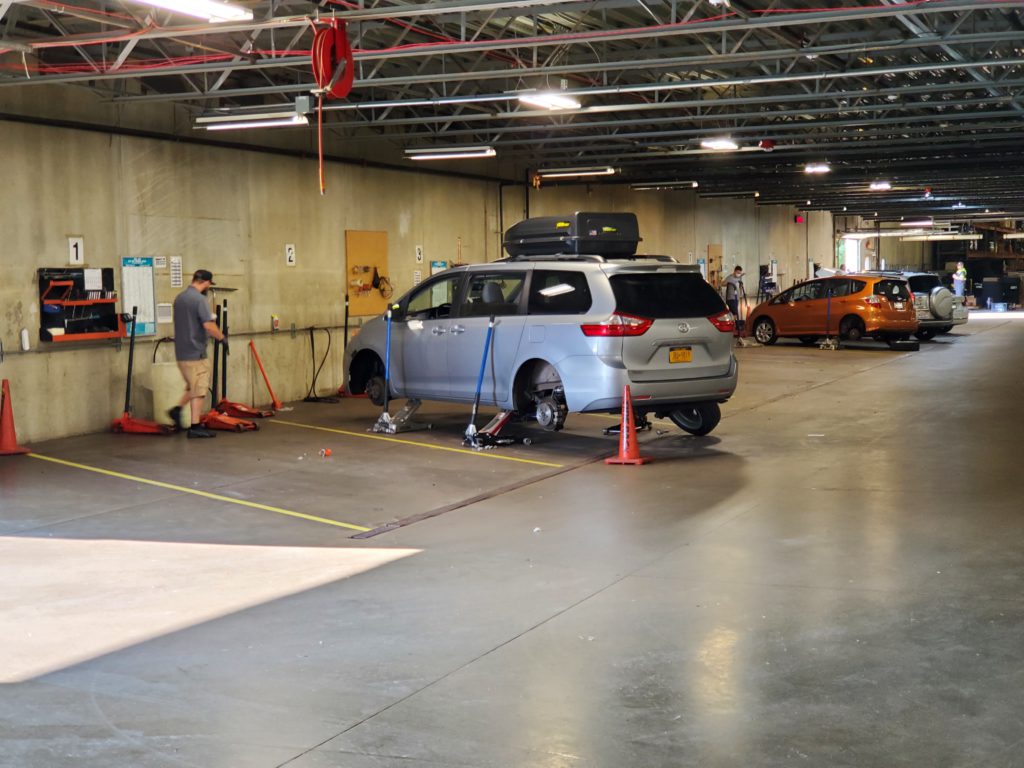
I and many others bristle at the federal government’s mandate for a Tire Pressure Monitoring System (TPMS) on all new cars, but everyone should want this feature. Modern tires and suspensions are such that a deflating tire is often unnoticeable while driving until it’s almost completely flat. My wheels always seem to be extraordinarily magnetic in that they frequently attract nails and screws (or maybe it’s just the strange places I drive). At any rate, my tires develop a lot of slow leaks. By warning the driver when the pressure drops to 75% of normal, TPMS has saved me from ruining several tires in recent years. It often allows a simple plug or patch instead of necessitating replacement. Unfortunately, the 2006 Chile Subaru doesn’t have TPMS, so two of the six flats down here, including this one, went unnoticed until the tires were ruined. Of necessity, I buy two new tires, which is not too painful as I was considering replacing all four, despite their substantial remaining tread, before we reached the wilds of Bolivia and Perú. Unfortunately, the tire size I need is not a common one and the only suitable pair in stock are an unknown make called Goodride. The four Yokohamas I bought last January in Buenos Aires have been outstanding on the brutal roads we constantly drive and I was hoping to stick with that brand, but for these first two I have to take what I can get. At least they cost only a fraction of what the last ones did.
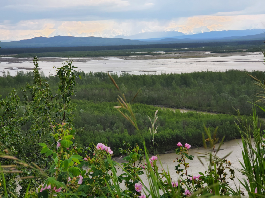
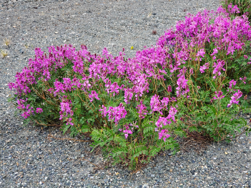
Newly tired, we set off up the coast at about noon, working our way through the urban traffic of Coquimbo and La Serena. North of there as the main highway turns inland, we veer off on a side road that returns to the Pacific coast. It starts out paved but unpredictably transitions back and forth to gravel. We pass through an arid wonderland of expansive views of the rugged, rocky coast and desert with many blooming cacti and other plants. Although we’re here at the right time of year to see the “flowering desert”, where about 200 species of plants bloom in a short period, the full effect only happens when spring rains arrive. Those rains are absent this year, so we don’t get the overwhelming effect, but there are still many flowers to be seen this month. Periodically, the road is occupied by a variety of livestock, including goats, sheep, horses, and burros, but no wildlife whatsoever. Even cows are absent in this part of Chile.
Eventually we turn off one almost deserted road onto another, Route D-180, which heads away from the coast and up an impressive set of switchbacks into the coastal mountains. After a dizzying ascent, we level out on an inland plateau with a network of narrow roads. Following the map, we leave one gravel road for an even smaller one. This doesn’t look right, but that’s not unusual for our routes. The track winds up through the front yard of a small ranch, another poor sign, and then turns into a washed out jeep trail. Ever hopeful we continue bouncing along until around a bend a locked gate appears — no getting past that. Retracing back through the ranch, we take another option not even shown on Google Maps. In these situations, the satellite photos are often either helpful or misleading. On the one hand, Google is pretty good at figuring out which existing roads are closed to the public and not depicting them on the map. On the other, when they get it wrong, the photos can reveal routes the map omits. In this case the latter applies and 500 meters of unmapped road connects us back to the known network and we choose a new route forward. Moments later, we pass the other end of the unexpectedly closed road and it is marked “Proyecto Dominga”, the very mining project that Patricia and Carolina and their village is fighting so hard to stop. Not long after, we roll into their village, Los Choros, and with a few inquiries we find the house of Patricia’s husband and mother-in-law, . She’s the only one home, and when I explain that we met Patricia and she urged us to stop by and meet the family, all I get is a repeated and puzzled, “Well, what do you want?” Apparently, Patricia didn’t advise her family we were coming. Husband, Ruben, is out working until late, so we give up and head toward the beach for another dune picnic. Hunger satisfied, we decide to find a cabaña in Los Choros and see if we hear from Patricia or Ruben later on. The cabin is comfortable, the female manager very accommodating, and we relax for the afternoon, cook a great dinner at night, and play with the 2 friendly dogs. A message from Patricia implies the family won’t be in touch, so we sack out to the sound of shore birds and distant surf.
Day 11, Sat Oct 27: We enjoy the cabin all morning and roll out at noon to continue north. It’s only a short hop to Punta de Choros a fishing and tourist town in a cove near the Humboldt Penguin National Reserve on two offshore islands. I only recently found out that this species of penguin lives far north of all but one of the others, with colonies along the Pacific coast of Chile and Perú. The Galapogos penguin is the most tropical of all but, then again, in the Galapagos Islands every species of plant and animal is more or less an exceptional case. Since the Humboldts can only be viewed from the water and we’ve seen hundreds of thousands of other penguins up close in our travels we decide to forego this opportunity. I spend a while discussing local issues and Chilean politics with a young naval officer on duty at the fishing harbor but ultimately, realizing we can’t stop everywhere on our long journey, we move on. The road traverses some rugged coastal scenery demanding several gawking stops and sand road forays before turning inland toward the dry, austere coastal mountain range.
Still encountering an unpredictable mix of pavement and gravel, we head up Route C-494 into the mountains. Ascending a long, complex set of switchbacks, we are treated to distant views of the coast we have left behind. Once up high, we encounter a long section of rerouted road where about two feet of gravel has been deposited in the northbound lane for future construction, forcing traffic in both directions to travel on the single southbound side. We only encounter a couple of oncoming vehicles, but when it happens, we’re both required to veer into difficult terrain to pass each other. All through this high country, we pass evidence of many small mines, most apparently abandoned. This is copper and iron country and I speculate that these small works are copper mines, since a small iron mine is probably not financially viable. Along the largely deserted road, we pass one active mine and squeeze past an inappropriately giant tour bus probably being used to shuttle mine workers from the distant coastal population centers. At one point, a small homestead displays a sign “Se vende huevos” (Eggs for Sale), so we go up the driveway to buy some and make a little conversation. The owners are very rural and isolated but friendly and we confirm that it is copper being mined, along with one area of cobalt, an even more valuable metal. We continue on with eggs in hand. As the road prepares to descend to the coast again, we’re surprised by a very large, crumbling, abandoned set of mineworks at the head of a dizzying set of switchbacks to the valley below. We’ve driven many mountain roads in Chile, by turns paved, gravel, and mud but this unheralded descent is the most impressive – easily besting the famous Paso del Libertador paved highway connecting Chile and Argentina. The sinuous trip down is spectacular in scenery and engineering, and requires some focused driving due to the lack of guardrails and low curve visibility – a delightful surprise.
At the bottom, finally, we soon reach the ore port town of Huasco where we manage to dig up a really nice overnight apartment run as a side business by a local couple. For the low price of $45, we get a perfect 3-bedroom place in a clean multi-building complex. It even has a beach view — as long as you stand up to look over the protective perimeter wall outside. The best feature, though, is the well equipped kitchen. Many of the apartments and cabins we’ve rented have inadequate cooking facilities: two finicky stove burners, no oven or microwave, tiny refrigerators, and minimal or missing pots, frying pans, and cooking implements. This is the best we’ve seen — everything we need to comfortably cook a big dinner and replenish our ice supply for tomorrow’s travel. There’s even that rarest of amenities, a washing machine! We sleep to the sound of the not so distant surf.
Day 12, Sun Oct 28: After a breakfast using our farm eggs and replenishing groceries and gas, we cruise around Huasco on a quiet Sunday morning. The now-defunct lighthouse at water’s edge is a riot of murals so we walk over to take a closer look and photograph it. In the entry, an artist is selling his wares and we say hello. His name is Moises (Moses) and we quickly establish a rapport with him. He’s a gregarious guy (as are most vendors) and when he finds out Susan is a poet, the conversation gets serious. Within minutes, we are exchanging life stories and he’s reading his poetry to her (as I struggle to crudely but simultaneously translate). An exchange of gifts ensues and he invites us to climb the lighthouse stairs for its view of the beach and harbor. As we return to the lobby, he has out a flute and plays one of his original compositions, then gives us one of his CDs as a further keepsake. Wanting to help him out a bit financially, we buy one of his carved rocks (he’s already given us a similar one) and with multiple goodbyes and invitations walk back to the car. One of the ever surprising things about traveling is these brief but intense encounters with people we may never see again but with whom we develop an “instant” relationship. In addition to deeper contacts we make, these interactions are one of the rewards of our travels.
We head north into Llanos de Challe National Park. With broad, sandy beaches and interspersed rock coast on one side and austere, cloud shrouded mountains on the other, we proceed slowly, gawking in both directions. Not very far from Huasco, we encounter the park’s most developed area, a very attractive sandy campground among coastal rocks and an inland trail across the road. Within minutes of arrival, Susan expresses interest in camping overnight and I persuade her that the soft sand, protective boulders, lack of mosquitoes, and almost zero chance of rain mean we can sleep out without setting up our tent. We choose a nice campsite at the base of an interesting rock formation, with table and benches, and set up camp. Although there is a fireplace, this area has absolutely no trees. Campers must bring their own wood or charcoal from home. The lack of a fire is offset by the unexpected lack of fees. In this off season, equivalent to our April, the campground is open but no one is collecting any money. We’ve stopped early in the day and we pass time walking the beach and the small community of beachfront shacks, exploring tide pools, and beachcombing. Since we aren’t traveling with a camp stove, we have an early cold cut dinner and lay out the sleeping bags on the soft sand.
Just past our site, workers with trucks appear to be setting up for an outdoor meeting in the sand — over a hundred chairs, tables, lighting, a projection screen, and a portable generator. Given our distance from Huasco or other settlements, this seems rather odd. Around sunset, two buses pull in and disgorge their passengers who all head for the beach. As darkness sets in, they all come back to the event area and take seats. I walk over to kibbitz as a gentleman with a laser pointer starts a slide show. The subject turns out to be astronomy for the common folk and I’m not sure it will be of interest to me as he starts out explaining the concept of northern and southern hemisphere and asking whether the audience knows which one they are in. It gets much better from there, though, as he launches into an explanation of why Chile is important to global astronomy. Among others, the reasons are that stars in the southern sky aren’t visible in the northern hemisphere, the center of the Milky Way galaxy is only visible in the south, topography means northern Chile gets little rain or cloud between the coastal range and the Andes (the same reason for the existence there of the super-dry Atacama Desert), northern Chile’s low population means light pollution is less of a problem, and that closer to the equator atmospheric water vapor is more dense and degrades astronomical observation. He then described, one by one, each of the existing and planned observatories and their specific observational strengths. Despite my inability to follow everything he said with my limited Spanish skills, it was very informative and hardly what I expected when we decided to camp overnight. At the end I find out this is a one of a series of city-sponsored field trips and talks for local residents to acquaint them with nature and science.
Warm and cozy, accompanied by a campground cat who spots Susan as an immediate sucker and spends the night in our sleeping bag with us, we sleep on our soft sand mattress, bothered only by an occasional mosquito buzzing in our exposed ears and grabbing a blood snack.
Day 13, Mon Oct 29: Waking in the morning to the same cloudy but pleasant weather as yesterday, we eat, pack up, and drive across the road to the inland side where there’s a trailhead. The interpretive signs along the 2 mile trail explain the unique ecological situation. For various atmospheric reasons, onshore winds from the Pacific carry very little moisture, enough to produce perpetual clouds but almost no rain. The moisture from these clouds is blocked by the coastal mountains and allows a variety of plants and a few animals to flourish on those slopes in a way they cannot do further east. The trail is full of cactus and other suitable plants, many of them in bloom today. As the trail climbs, we also get birds eye views of the ocean and beaches. It’s a very rewarding walk through what at first seems an austere, forbidding landscape.
On our return to the car, we continue up the coast. For the next 3 hours we are occasionally in sight of the ocean, but mostly in bland desert plains, including a very long detour inland where a 10 mile section of highway is closed for construction. By 1 pm we’re back on a scenic coastal road and on reaching the town of Chañaral we decide to find lodging in mid-afternoon to avoid the frequent frustration of paying a lot of money late in the day and just getting a bed for it. We find a nice cabin with a nice waterfront view, but its perched right above the highway and the area inside the perimeter wall is totally paved without any greenery whatsoever. At $62, it’s not an incredible value but it will do for the night. I walk to the supermarket to pick up dinner groceries and on my way back I notice a possible bad omen for the town: the clock tower is the evening roosting place for about a dozen vultures. Dinner is hamburgers, baked potato, and spinach and we fall asleep to the mixed sound of surf and trucks.
Day 14, Tue Oct 30: Chañaral is a hillside town so after packing up we take a walk around before leaving. There are some excellent murals and it has a typical Chilean flavor, but the vultures are unsettling. Curiosity satisfied, we drive north a short distance in strong, cloudless sun to another national park, Pan de Azúcar (Sugarloaf). Our first stop is a deserted beach with surf spray flying 20 feet into the air as large swells hit the rocks. We work our way out toward the action, stopped by a large tide pool being refreshed by the tidal surge. As I get to the edge, I spot a huge starfish clinging to a vertical rock face, bright red with about 40 arms. In the few minutes it takes to run back to Susan, who’s coming up behind me, get the camera, and return, the star is gone — no longer on the rock and nowhere to be seen in the large and complex tide pool. Having always thought of starfish as sedentary and slow moving, I’m shocked and disappointed and have to satisfy myself with a few photos of bright orange anemones.
Back at the car and on the park road, proceeding a little further, we find another stunning beachfront campground and Susan suggests that if we had known about it we could have come here last night instead of the cabin, which would have made two camping nights in a row. At this point it’s too early in the day to stop and too late to explore on foot due to the fierce sun. Reluctantly, we move on into interesting rock formations but since the road network is limited and it’s too hot for even modest trail walks at this time of day, our access is limited.
Leaving the park northeastward through arid, multicolored mountains, our route is mostly inland for the next couple of hours until the road again parallels a sandy cove. Looking down on the beach as we drive by, I see a stationary car near the water line, surrounded by about 6 people. Rightly surmising that it’s stuck in the sand, I park on the shoulder and jog down the beach. On arrival, I see the situation is quite grave. A brand new Subaru Outback is stranded in soft sand up to the chassis with the incoming tide is about to reach it. The group is futilely trying to push the car upbeach into more soft sand, but with the chassis hung up, they’re getting nowhere. My immediate suggestion is they push it backwards on to the wet, harder packed sand compacted by the wave runout just a few feet behind the vehicle. As the newcomer, old guy, and obvious foreigner, I’m ignored. The young owner is trying to stay cool but he knows he’s only a few desperate minutes from seeing his car claimed by the salt water. After helping with some hopeless pushing, I do the only constructive thing I can, lie flat and use my arms to scoop substantial amounts of sand out from under the chassis to allow the tires to get some traction. Within a few minutes, the driver also decides that backward is the way to go, so sand is cleared from behind the rear wheels and with a few inches of forward wind up, we’re able to push and rock the car in reverse onto the wet sand and shallow water where the driver backs up furiously looking for safer but still tractionable ground. He finds a temporary refuge, lets air out of the tires for additional traction and manages to blast his way up the steep beach back to the highway. Given the newness of the car, I imagine he was taking it out to show its stuff and, through inexperience, got in (almost literally) over his head. A Subaru can do an awful lot, as I frequently demonstrate, but once the chassis is hung up only skill and external assistance, not torque, will move the car. He’s a very lucky guy that he missed by 5 minutes watching helplessly as his $30,000 toy became an offshore island.
Satisfied with my role, however unacknowledged, we proceed a bit further into the beach town of Taltal, once again deciding to pull up well before dark to make our hotel money a better investment. We stop at the municipal library hoping to find fast internet to speed our lodging search. The library staff person is very helpful, and speaks English! He shows us how to log in to the public library wi-fi and informs us that the same login will work at all libraries throughout Chile! He also recommends a cheap hostel a few blocks away and mentions likely more expensive alternatives. We check out the hostel but despite having a private room available, Susan isn’t content, so we say we might return and look further. At the one beachfront facility, which looks like it should be far more expensive, we’re surprised to find they have a perfect room on the water side, private bathroom, an included breakfast, and once we negotiate our exemption from the 19% tax, a bargain rate less than double that of the hostel — at $57 still cheap and a much better value. We bring our necessaries in from the car and spend the next few hours walking the beach and checking out the small town action along the waterfront esplanade, returning to our room after sunset to read and eventually sleep to the sound of lapping waves at the shore.
Day 15, Wed Oct 31: Taltal is near the beginning of Ruta 1. Its name and its coast hugging route convey the impression it’s a major highway, paralleling the Panamerican Highway (Route 5) for 400 miles, and someday it might be. At the moment it’s missing a 35 mile gap, so while the northern portion lives up to its important promise, the 100 mile southern part that we’re about to traverse is an almost deserted gravel road mainly used for mining access. We drive this for a couple of hours, marveling at the grand but forbidding scenery of mountains with enormous sandy outwash plains (doubtless formed during a much wetter era) and virtually no vegetation. Except for a lunch break at a somewhat less forbidding beach access, we drive the entire road in one stretch. When we reach the gap, in major copper mining territory, a different route heads inland, steadily climbing from sea level to about 6500 feet without delay. Once at the top, we stay inland for a while until we abruptly return to the coast to enter Antofagasta, the regional capital and largest population center for northern Chile. Antofagasta isn’t particularly attractive and we stay overnight in a pleasant 4th floor apartment. It’s Halloween, and Chile has adopted the holiday U.S. style, so as we walk to the supermarket to get dinner ingredients, we pass many costumed children out trick or treating with their parents. Somewhat curiously, they all seem to have commercial costumes. I didn’t notice even one with a homemade getup. Since the city fails to arouse our interest, it becomes merely an overnight stop.
Day 16, Thu Nov 1: Today is the start of a 4 day holiday weekend which seems to include shopping promotions similar to our Thanksgiving. The actual holiday is All Saints Day and tomorrow is “Black Friday”, a direct clone of our sale day of the same name. We’re spending the afternoon cruising up the paved and developed segment of Route 1 to Iquique, where we will do some shopping for car parts and other supplies before leaving commercial civilization for the desert and Bolivia. The coastal drive along the desert coast is pleasant and we make a few stops to explore shorelines. As we approach Iquique, an oncoming bus flashes its lights at me. I’m not sure if he means “speed trap ahead” as we’ve seen zero traffic law enforcement throughout all our time in Chile and Argentina, but I reduce my not unreasonable speed anyway. A mile or so later as we come over a hill, there are two policemen with a radar unit at the bottom and they wave us over. My strategy when encountering police or other road officials is to not speak any Spanish. Virtually all our interactions to date have been at routine checkpoints, where faced with a driver who can’t understand them, we’re generally waved through after a couple of questions. These two, though, are in the ticket writing business and even though they can’t communicate with me, they explain that I was going 46 mph in a 38 zone. Since the road was empty of traffic I didn’t think they would see this as a major offense, but they did. I eventually get a ticket handed to me, but much worse, they keep my license, explaining that I can get it back Monday after paying the fine (the delay is because of the holiday weekend). They have no idea that I understand what they’re saying but they also don’t care. We knew our Iquique shopping would be delayed because of the holiday, but now we’re definitely spending 4 days here no matter what. My so far successful “Sorry, I don’t speak Spanish” strategy might, this time, have been a poor choice, but maybe speaking to them wouldn’t have made any difference. In any case, now I know that although enforcement is extremely rare, it’s not to be trifled with.
Proceeding into town, we head for lodging we have booked sight unseen, a practice we try to avoid. The room is airless and otherwise unsuitable so we negotiate a cancellation and sit in the car researching other options. As we’re looking, the car shakes as if someone is bouncing on the rear bumper. It only takes a second or two for me to realize it’s an earthquake tremor. A few seconds later there’s another one. In a parked car, all we can do is hope this isn’t going to be major – and of course it isn’t. I’ve felt a variety of mild earthquakes over the years and the most interesting thing is that the mind resists the explanation that the normally stable, solid earth is moving. Our brains search for other causes first: impact, vibration from heavy equipment, wind, etc. Chile experiences many mild quakes and the locals hardly even look up from what they’re doing.
We book a nearby apartment sight unseen, receive an automated confirmation, and by the time we arrive, we haven’t yet heard from the owner with check in details. Finally I call – always a last resort with my Spanish — and the conversation takes a comical turn until I figure out that the other person thinks we’ve booked something they have in Santiago, a thousand miles away. Once I explain we’re in front of a building in Iquique, I’m told, “Sorry, that apartment isn’t available.” When I express my distress at the false confirmation, they offer to arrange other lodging for us, but of course they never call back. We move on to a third booking, an expensive apartment hotel. At this point, during a holiday vacation weekend in a resort town, we’re forced to take what we can find. The hotel lobby looks water damaged, but the high rise apartment is excellent, modern, and well designed, if very pricey. Their protected parking is only two blocks away, but due to the language barrier, it takes about 6 long one way street driving circuits and 3 further inquiries until I finally find the entrance and get the car situated for the night. We eventually fall asleep staring out the big windows at the panoramic city/ocean view.
Day 17, Fri Nov 2: As nice as our little apartment is, we’re not going to keep spending $120/night for it, so we book another for $80 and exit the hotel. As I’m paying the bill, I ask how the lobby was water damaged and am informed that there is no damage, that’s the decor. Oops. Apparently their designer went with a “leaky plumbing” motif. Our follow on lodging is an apartment on the 12th floor of a beachfront high rise. The owner has allocated the guest bedroom, its bathroom, and the large balcony for guests. We share the kitchen, living/dining room, and washing machine (always a valuable amenity when we find it) with her. The view from the balcony, which is fully enclosed by coarse netting, encompasses a long stretch of beach on one side and the arid mountains backing the city on the other. 12 stories below is the complex’s enormous swimming pool, populated not by happy swimmers at this hour, but by cormorants and seagulls. Swooping among the high rises are a number of vultures often passing within feet of us. This is doubtless the reason for the balcony netting. After a while we realize they’re landing near the pool where they line up and stare out at the ocean.
As visitors to the complex, the initial security procedure is extensive, but now we’re equipped with keys and an access card, so we venture out into town. Although we’re sure everything will be closed today for the holiday, we drive up to the duty free zone to check out what stores are available for tomorrow. I’m hoping to get a good deal on a second pair of rugged tires and some spare oil filters before we leave Chile for non-Subaru countries. Remembering the enormous selection at the Abu Gosch supermarket in Punta Arenas, far far to the south, I’m also hoping to stock up on some foods that aren’t typically sold in Chile. Arriving at the zone, we’re surprised to see it completely open and crowded to capacity with cars and people. When we finally locate a parking spot, we get out and look around. Unlike Punta Arenas, this zone is primarily one giant indoor shopping mall with just a few ancillary businesses outside. One is a tire shop so our first stop is there to see what’s available. I’m hoping to find Yokohamas similar to the prior set which has given us excellent service under very harsh conditions. This shop, though sells only Michelin tires and I’m unwilling to pay top dollar (peso, rather) in a place where I was expecting at least a modest deal. Moving into the mall, we encounter an amazing glut of stores and products aimed at the up and coming middle class, and a large part of that class is crowding every square foot. Similar to U.S. malls, after looking at and into dozens of stores, Susan and I agree there’s absolutely nothing here that we would want to buy and after a painful hour we leave with nothing but relief to be out of there. Fortunately, we drop by Walmart to pick up some groceries and I notice a same-named version of our Black Friday sale is in progress, except here it runs the whole holiday week. This doesn’t mean much to me at first until I happen to walk by the tires section and see that they’re all 30% off. A quick look through the racks locates just one pair of the unusual size I need, so I grab those and, presto, 2 new $90 tires for $65 each — score!
I do not want to head into Bolivia and Peru without 4 new tires, but since the remaining two of my older Yokohamas still have quite a bit of life left in them, we cast a critical eye on the available space in the car and decide to carry the 2 unmounted new tires in the back seat rather than immediately mounting them and discarding the old ones. This is a somewhat cumbersome solution but it allows us to keep the new pair in reserve until they’re actually needed down the line.
Due to the traffic ticket, there’s no option to continue on until I retrieve my license on Monday, so we decide to spend the intervening days relaxing and catching up on various tasks and chores. Recreationally, Iquique is exclusively a beach and shopping town. While we both like the coast and ocean, we’re definitely not prone to spending hours out in the sun and sand, so there isn’t too much reason too swoop down, vulture-like, from our cool, comfortable 12th floor aerie. The view and the cooking facilities encourage sloth, so we succumb without guilt.
Day 18, Sat Nov 3: Lazy day today. Long walk on the beach until it gets tedious. Parasailers launch from the high mountains behind Iquique and a steady stream of them lands on the beach right in front of our building. On our way back, we stop at the giant pool and take a swim. The cormorants and seagulls move around to whatever part of the pool isn’t occupied by the few human swimmers. Close up we can see that the big attraction is fresh water. Immediately in landing, the birds start drinking from the pool and after resting and socializing a while they fly off to, presumably, continue fishing. We drag ourselves out to do some shopping and reluctantly eat an expedient hot dog lunch at the shopping center food court. Susan gets a nightgown, to avoid distressing any hosts in whose living room we may sleep, and I resentfully buy another day pack to replace the one I just discovered I stupidly left behind in our Chañaral cabin last Tuesday.
Day 17, Sun Nov 4: Complete day of sloth. We sit around the apartment working, writing, staring, talking with our host Jaqui and family. Her son works in the city jail and offers to accompany me on tomorrow’s driver’s license retrieval. Should be a big help. Nonetheless, I’m making contingency plans if I don’t get it back: report it lost and have a new one reissued, then figure out how to get it here in South America. This would mean weeks without a license in my possession. This might work, as at the many police checkpoints and border crossings I’ve almost never been asked to present my driver’s license, but it would still be a very risky strategy, On the other hand, we can’t just hang around Iquique indefinitely waiting for the bureaucracy to grind through its process. We just heard a story about a Chilean whose license was lifted in the far south and required about a year to get it back in far northern Iquique!
Day 18 Mon Nov 5: Big day today, as it’s important to argue speeding ticket, pay fine, and get my license back so we can move on. Despite his promise, Jaqui’s son is not at the apartment to accompany me at 8 AM to the court. His younger brother kindly offers to come with me, but due to his age I have little confidence that he knows the system. I’ve worked up my own statement in Spanish to present in an effort to get the fine reduced or suspended. We drive to the correct neighborhood and find one of the last places to street park and go into the court building. After a few minutes standing in line with other supplicants, I notice a sign that clearly says, “Driver licenses are returned only when you present the fine payment receipt.” A couple of questions to the staff tell us I must first pay the fine at the city cashier office, a hefty walk away. More significant is that I cannot make a case to anyone regarding the circumstances or the size of the fine unless I wait for the hearing date of Nov 21, which is effectively impossible.
We have exactly the same situation in the U.S. If you receive a citation for anything and cannot return for a scheduled hearing in several weeks or several months, your right to due process is essentially voided. If you can’t appear, your only choice is to mail in a guilty plea and pay the scheduled fine. Hiring a local lawyer to represent you will certainly cost more than any reduction you might get and traveling 500 or a 1000 or 2000 miles to appear personally is obviously impractical. The only court system I know of that accommodates tourists and travelers is that of Juneau, Alaska which for many years has offered telephone trials for citations that give defendants a chance to attend a hearing remotely.
We slog over to the municipal building and try to pay the fine but the cashier raises a good point. When your license is lifted in Chile, the paper citation you’re given in exchange serves as your interim license. Based on the citation info, the cashier recognizes that the license will not yet have arrived at the court today, so if we pay the fine, she will keep the citation and I’ll have no document that authorizes me to drive. This is a point well taken, so we trek off in another direction to the police station to confirm whether or not they have delivered my license to the court. There, a polite but clearly impatient officer explains that because the license was taken south of the city of Iquique and not in it, it will take 4 full days and will probably arrive at the station house late today and, if so, not get to the courthouse until tomorrow.
That aborts today’s effort, so I take the son back home and set out on all the other errands that need to be accomplished before we abandon the beach for the desert wilds. At a Home Depot-like store, I buy a shovel, an important emergency tool I’ve been procrastinating. The Subaru can go a lot of places, but if it should get even modestly immobilized in sand or snow, there’s little you can do to get loose without a shovel and a lot you can do with one. We’ve been fortunate in all our off road adventures never to get stuck. The weatherstripping on our windshield came loose last week and I tied the end to the outside mirror. It hasn’t rained at all yet, but when it does a lot of water will come inside through the breach. I find the only auto glass shop in Iquique and for $8 they reglue the rubber strip in its proper position. I also buy a few spare oil filters since I’m not sure they’ll be available outside Chile. Since Iquique has a Bolivian consulate, after driving to a library to print out the visa forms I prepared online, I head over there to complete the visa process. This is a complete waste of time, as the woman in the consulate looks up my application online and curtly hands me an additional batch of manual forms and a long list of required documents including statements from the police that neither of us is wanted for any crimes in the U.S.! This is all completely different from what I was told at the embassy, so we’re back to getting our visas at the border.
Day 19 Tue Nov 6: It’s do or die for getting my license back. If it doesn’t happen today, I’m seriously considering abandoning it and moving on. I head out alone to the city cashier, pay the fine which amounts to a punitive $81, walk over to the court where I present my receipt and — lucky, lucky, lucky — the clerk sorts through a 4 inch high stack of licenses and finds mine. To check up on what the police told me, I ask when it arrived and she says late yesterday – I couldn’t have taken care of this any faster than I have. With the license back in my possession we’re clear to finally blow town. My final errand is to buy liability insurance for driving outside Chile, which is expensive and far more time consuming than it should be, especially since I’m already a customer of the company. With that in hand and a full tank of gas, I race back to the apartment, we load up the car and head east into the heart of the Atacama Desert, one of the driest places on earth.
Since we’re getting a late start, I have a fairly modest plan for the rest of the day, about 210 miles to Ollagüe at the Bolivian border. Leaving Iquique to the east requires an immediate ascent from sea level to 3400 feet to reach the Atacama Desert plateau. The highway offers broad views of Iquique, and passes the parasailing launch park, source of all those flyers that were landing miles away on the beach. The desert landscape is dry, dry, dry and in this area very flat and featureless. Curiously, the area we’re traversing used to be part of Peru. Until the invention of chemical fertilizer in 1909, saltpeter deposits from guano were a crucial natural resource. Their value led Chile to go to war with Peru and Bolivia in 1879 and annex a big chunk of their coast and desert territory as northern Chile. This defeat is what made Bolivia the landlocked country it remains today. The vast nitrate deposits here were worked by labor intensive major mining companies until the industry collapsed. The old company towns, preserved by the arid climate, are now historical tourist attractions. For us, though, the blazing sun is enough reason to bypass those relics and proceed inland in air conditioned comfort.
Heading south and east, we cross large salt flats, clear evidence that this high country is actually raised seabed. Rain here is very scarce, and some areas never see it. As we turn inland on a paved road, the route looks like an easy ride with high mountains in the far distance. After a nice lunch in a roadside restaurant in Pica the road turns to gravel and begins a serious climb, topping out at almost 14,000 feet. I hadn’t planned on such an extreme one day ascent since such sudden changes can lead to very uncomfortable altitude sickness symptoms. Now that we’re up here we have only two choices — turn tail and spend the night at a lower, intermediate level, or forge ahead. Having regained a paved road and feeling pretty chipper, we decide to drive the remaining 90 miles, perhaps stopping earlier if the opportunity presents,
The highway, which roughly parallels the Bolivian border, presents some astounding countryside: Giant salt flats and enormous multicolored Andean valleys bounded by precipitous ridges. It’s looking like the remainder of the ride will be a piece of cake. 38 miles down the road, though, the smooth pavement segues into a secured mine entrance gate while our road veers to the left as a one lane dirt track. With 52 miles to go, we continue on to Ollagüe through what is likely a primitive road through very remote country.
I know it gets boring to hear “amazing road” over and over, but many of our ridiculously remote traverses fit that description. The road between the mine and Ollagüe winds its way up and down through the altiplano. We pass abandoned homesteads, large active mines, and rock strewn landscapes with bright green flowering plants getting their moisture from who knows where. In addition, it’s a full on driving challenge, especially since we’re at risk of running out of daylight. If that happens, we’ll definitely have to sleep in the car as I wouldn’t want to go half a mile in the dark here. The road climbs up and over ridges, along and across dry washes that present stretches of river rock and deep sand banks. On level sections we often encounter bone rattling washboard road surface which restricts us to walking speeds. At one point we catch a glimpse of an elusive mara, only our third sighting of a rare rodent that has evolved to look like a rabbit.
Hours later, with little daylight to spare, we finally roll into Ollagüe, a very remote border and mining town. The visual impression is dominated by derelict cars of the railway that connects Bolivia with the Pacific coast. The line looks abandoned but is actually operational. We’re grimacing at the thought of what a hotel here might consist of but our only other option is the front seat of the car at 12,000 feet. Inquiries of the only two pedestrians we see point us to one lodging, but they tell us they’re full — quite a surprise in this apparently deserted outpost. The owner gives us vague directions to an alleged second (and only other) hostal. A few iterative loops through the community and we zero in on it. From the outside it doesn’t look like much but we’re pleasantly surprised by the warm atmosphere inside and the very nice, if windowless, available room with private bath. The price is a bargain, too, especially as we obviously aren’t in any position to haggle. It’s been a long day, so we sack out quickly but during the night altitude symptoms develop. Susan is quite miserable and pops one of our limited supply of acetazolamide (Diamox) pills. You’re supposed to start them 24 hours prior to ascending, but she finds that taking them on demand provides relief fairly quickly.
Day 20 Wed Nov 7: We leave Ollagüe, on a paved road for a change, for San Pedro de Atacama, the tourist gateway to the Atacama desert. The remote road skirts many salt flats and salty lakes and we’re enjoying the relative desolation. Since there’s no question of internet access, we spend the day completely in the dark as to the results of yesterday’s U.S. election. Susan is cautiously optimistic while I expect nothing more than Trump-affirming national disaster. We’re on the lookout for flamingos, which typically feed in such shallow, briny water, and we spot a medium size flock to our left. I take the car off the road for a closer approach and we spend a half hour or so observing these graceful birds probing the lake mud for custaceans. Grazing near us is also a family of vicuñas, a wild relative of the llama, alpaca, and camel. We arrive without incident in San Pedro in the early afternoon and find that just gassing up is a long process as the town’s lone service station is at the end of a dead end spiral with cars, tourist expedition vehicles, and trucks lined up for blocks to squeeze into and then out of the tiny but essential cul de sac. We find acceptable lodging on our 3rd try and settle into a nice, cool 2 floor apartment with a large terrace in a walled compound. In yet another novel interpretation of the Chile hotel tax exemption law, the young couple who own the place insist I can only get the discount if I pay in US currency, so I dig into our small stash and come up with the necessary $70. Handing it over, they inform me that the banks will only accept notes in near perfect condition so we go through my little pile to find acceptable specimens, those with no nicked corners, tiny tears, or noticeable creases. Deciding a couple of hours later to stay a second night, I go through the payment ritual a second time but having negotiated a modest discount.
San Pedro is an adventure tourism destination, filled with bronzed, scantily clad, young people seemingly oblivious to the concept of skin cancer. They use the town as a base for mountain biking, volcano climbing, and other sports utterly inappropriate to the the thin air. We’re also told it’s a drug mecca but have no way of verifying this. As a tourist town, lodging is relatively expensive but we’ve gotten a fairly good value. We cook ourselves a tasty beans and sausage dinner, eat outside in the shade with accompanying dog and cat, and take it easy, hoping that a night at a much lower 8,000 feet won’t undermine our body’s nascent acclimation to thin air. Only then do we muster the courage to check out election results. We’re gladdened by the flip of the House. Although it’s far from a defeat of Trump and his fact-free, nativist supporters, at least further legislative damage will be blocked for the next 2 years, although the Republican have already done a pretty good job of that with their infighting. Personally, my biggest satisfaction is that our House District NY 19 has finally mobilized enough apathetic Democrats to outvote the rednecks and throw that Cheshire cat smiling, contemptible, slimeball, disgrace of a Congressman John Faso out of office. Okay, maybe that was too many harsh adjectives. Let me simplify it to “lying sack of shit”. At any rate, with the aid of those minimal but encouraging results and some thicker air, we get an easy night’s sleep.
Day 21 Thu Nov 8: Today we are heading up into the high country of the expansive Los Flamencos National Reserve. Both of us have taken precautionary Diamox and within an hour we’ve ascended a dramatic 6,000 feet to the park entrance, hoping we won’t get any serious symptoms through the day. Once again, it’s impossible to convey the wondrous landscape. Salt flats, the road winding through amazing topography, some lifeless stretches and others filled with plants taking advantage of any available water. We quickly ascend to 16,000 feet, higher than either of us has ever been outside a pressurized airliner cabin. The winding park road stays near that elevation all the way to the Argentine border, and we make numerous stops all day long. Despite the lack of rain and flowing water, the rocks are brutally eroded by wind blown sand, yielding fantastical formations including many pinnacles towering over the sand base. We find reason to investigate something or other frequently and, except for the immediate breathlessness brought on by walking even 50 feet, we suffer no ill effects at this sustained, record breaking elevation. The highlight of the day is encountering a flock of 12 flamingos feeding in a salt pond immediately adjacent to the road shoulder. We spend almost an hour observing them at less than 60 feet away. Once we reach the border we retrace our way back to San Pedro, amusing ourselves with the various dire highway warning signs, “No cell service for 90 miles”, “No gasoline for 100 miles”, “Dangerous curves”, etc. Returning to our cabin, we again get a restful night’s sleep at the lower elevation. Apparently, we are acclimating quickly to the high country, which is good because there’s much more of it ahead.
Day 22 Fri Nov 9: This morning we get an early start because we’re leaving Chile through a small border crossing that enters one of the most remote portions of Bolivia, its extreme southwest corner. We start out repeating the rapid ascent from San Pedro’s 8,000 ft to 14,000 ft. We’ve exited Chile with our car six times so far and it’s never taken more than 30 minutes, so we’re not anticipating any problem whatsoever. The first step involves getting our Chilean exit recorded in their system and the second is to get a form saying we’re temporarily taking the car out of the country. The customs guy tells us the Bolivians won’t let us in without a notarized affidavit swearing we are only importing the car to Bolivia temporarily. We tell him that, at this point, we’ll take our chances and he tries to process the car exit form. He’s having trouble, so he calls over a younger, more experienced colleague who explains the problem to him and then turns to us. To my complete shock after all those easy exits, he tells us that as Chilean non-residents we are prohibited from taking our Chilean car out of Chile. I already knew that Argentina has such a restriction, which is one reason we didn’t buy and register a car there, but his news is a devastating surprise. If this is Chile’s new policy, it will be expensive, cumbersome, or impossible to drive out of the country. The kid is very friendly, very empathetic, but very clear. The policy he says, is nationwide, but it is strictly enforced by this region’s (equivalent to a U.S. state) Customs agency. If he lets us out, it could cost him his job. He says we might be able to cross in the regions to the north or south, but we definitely aren’t getting out here. As we’re leaving I notice a ping pong table in the inspection shed and I ask good naturedly if we can exit if I beat him at a game. He just laughs and shakes his head. Disaster has struck.
With no other option, we descend back to San Pedro and regroup. I call the Israeli owner of Suzisantiago, the company that helped us buy and document the Subaru last December, and ask what he knows about this. He says, yes, the policy — which makes no apparent sense — was instituted 2 years ago but in the last several months it has been enforced more consistently, especially in the north. They keep a database of which crossings are troublesome and which aren’t. He sends us that but says one of their clients used the main crossing into Argentina, north of Santiago, without problems yesterday. All the northern ones are hit and miss, mostly miss. I think briefly about trying to hire someone from San Pedro to be the authorized driver to get us into Bolivia and then paying that person’s return bus fare, but with the weekend beginning, finding such a person and having a lawyer draw up the necessary documents is probably impossible in less than a few days — if a cockeyed plan like that would even work. I next think of trying every border crossing heading south to see if we can slip through somewhere but Chile’s geography stymies that. The only longitudinal highway in northern Chile runs close to the coast. Although there are several border crossings, there’s no Chilean road that runs near the border. Every trip to a crossing is about a hundred mile side trip. If rejected, it’s another hundred miles back to the highway — clearly impractical. Reluctantly, we quickly realize our only option for getting out of the country, maybe, is to drive all the way south to Paso Los Libertadores (almost all the way back to our Santiago origin) and then head north the same distance in Argentina to the Bolivian port of entry at Villazón. This is going to amount to a 2,600 mile detour to get back to a point a couple of miles on the Bolivian side of where we just were. We’ll be driving the equivalent of a trip across the United States, and we still don’t know if we and the car will be allowed into Bolivia.
Committing to this crazy plan, I first go to a local lawyer and, for $8, have the affidavit mentioned by the Chilean agent drawn up. It’s probably futile but I want to cover whatever bases I can with Bolivian customs. We set out to backtrack the 1100 miles to the Argentine border, trying to go as straight through as possible within the constraint of having only one driver. Leaving San Pedro at 1:30 PM, without sightseeing, back roads, or recreational toll evasion, we make it 350 miles south to the beachfront hotel we liked so much in Taltal — one third of our insane and unwanted southbound “solution”. The only room available is a bit more expensive than last time, but spacious and with a balcony overlooking the beach. We sleep well, muttering subvocal curses at Chile Aduana (Customs).
Day 23 Sat Nov 10: Continuing south this morning, we race another 400 miles south, toll and fuel expense accumulating rapidly. As we pass through Chañaral, I get a fortuitous silver lining benefit of this forced retreat — I’m able to retrieve the backpack I left at our lodgings there, 9 days earlier. As night falls, we return to Coquimbo, where our recent host Luis graciously consents to letting us use his vacant apartment for yet another night. On the way, we pass the regional shopping center where I’m able to return the replacement backpack I bought up north. I manage this within seconds of closing time and feel fortunate to have gotten my money back. Luis’ apartment is comfortable and familiar and we fall asleep gratefully while bottles of water congeal in the freezer for use in our cooler tomorrow.
Day 24 Sun Nov 11: On our third southbound day, we decide to make a short coastal detour to check out something we were unaware of on the way north. A developer — all the shoreline in this upscale resort area is devoted to big homes and expensive condos – as a sales draw and amenity for residents commissioned an architect to create a trail for several miles along the rocky waterfront. The path consisted of various stonework segments, placed subtly wherever the existing rocks didn’t afford a walkable path. Without railings or lighting, the effect was said to be a true piece of landscape art. I had found few online references to this work even though for reasons unknown the developer had made it publicly accessible instead of being walled off and guarded like everything else along the water.
Today, using the available clues, we drive to what seems the most likely access point. Going down one steep driveway I ask a guard at a secure entrance gate where to find the public access to the trail. He assures us it is close by and points up the hill. We park the car in a likely spot but see nothing. I jog down the road a ways to see if anything else seems like the access, but to no avail. When I pass a jogger coming uphill, I ask him about it and he offers to show me the right spot. As we reach the Subaru, he points at a tiny break in the fortified walls below the road. Exactly where we’re parked is a 2 foot wide, unsecured, wooden gate at the head of a steep downward path. This is the public access. Optimistic, Susan and I descend a crumbling wooden stairway, beginning to get a view of the rocky coast. About 100 feet down, the hill steepens and the stairs are gone, victims of coastal weather and failed maintenance. Susan rightfully says she’s not continuing down the precipitous slope but I can’t resist. I can see some segments of the stonework far below so while she sits in the shade, I negotiate the steep, sandy slope with the aid of a short, frayed rope someone has attached to the last remnant of stairs. As I descend I’m wondering how I’ll get back up if this is the only outlet. At the bottom, I see some of the clever stonework I’ve read about. In one direction, the trail ascends to the south but behind a firmly padlocked gate — no more public access in this direction! I proceed to the north and the trail really is charming and artful. I’ve read that the north terminus is a small public park and reason it must have an exit back to the road. After some walking, the trail comes out to a small beach and I can see more stonework on the other side. Whether private or not, it’s clearly treated that way, with a driveway coming down from the secured condo development above and a set of tables and umbrellas installed on the sand. A woman is sunbathing — fortunately not au naturel — and when I call to her from a safe distance she is clearly unnerved by my unexpected presence. I apologize and ask her about the trail. She knows nothing but does say that I can exit via the driveway and gate with guard, apparently the same one I consulted earlier. As I proceed across the beach to where the stonework resumes, she disappears almost immediately, perhaps to call the police. I proceed along the trail, each stone stair and platform leading up, down, or across the landscape in a very novel way. After a considerable distance, the stairs ascend steeply and I emerge on a flat, landscaped space. This appears to be the park I had read about, but far from being a public space, it’s now the yard of a giant luxury home under construction on the high point. Clearly, the owners have completely reneged on whatever initial lip service was paid to public access. I work my way up the driveway looking for a way out to the highway, but encounter only barbed wire topped walls and a padlocked gate. Of necessity, I work my way back along the trail to the beach I crossed earlier and slog up the access road through expensive homes and condos in the blazing sun until I reach the inside of the guarded gate from before. A different guard is on duty as I explain that I came from the public trail but going back up to the access gate is impossible. This little man with a little power chooses to be an asshole and lectures me about how I’m breaking the law by standing in front of him on private property. I agree and say I just want to leave the property but he would rather continue to lecture. Finally, I turn my back on him and start walking back down to the beach and he lathers up into a loud voice, telling me I had better promise never to trespass again, a sentiment with which I heartily agree, and the gate starts to open. I walk the short distance to the car, call Susan up from the stairway where she’s waiting, and we resume our course to the border.
It’s only another 120 miles to the border and as another silver lining for this leg, we’ve decided to stay again at Hostal Berta, run by a family that took us in as family last December. We arrive by early evening and have a joyful reunion and they offer us dinner and drinks. Their little piece of gardened ground and their hospitality make this a very special place. After long conversations about family, Chile, and our travels we fall into a sound sleep, the only sound being a middle of the night ore train passing within 50 feet of us.
Day 25 Mon Nov 12: We decide to take a rest day at Berta’s and enjoy the surroundings. We take a ride into the nearby shopping town of Los Andes to get a little readier for traveling in non-Subaru countries. I have the oil changed, discovering in the process that the oil filters I was sold in Iquique are the wrong size. I buy a few of the correct ones and launch into a search for front brake pads and rear shoes. If I have to have the brakes replaced in Argentina, Bolivia, or Peru, I know the needed parts will not be available. I find a parts store and they have the pads in stock. Unfortunately, neither they nor anyone else in Chile seems to stock the shoes. It’s fortunate that in my experience rear brakes wear down much more slowly than front, since I can’t get those parts. We head back to Berta’s and pack up for an early departure. Our plan is to ascend the Andes before the border post at first light. After the first, famous 29 switchbacks the new highway goes through a long tunnel at about 10,000 feet but the old road still exists and climbs another 2,000 feet to the high ridge of the Andes. The first time we drove this way in December, I saw the sign for “Christ the Redeemer of the Andes”, and not realizing its commanding position, I dismissed it as just another South American religious shrine and drove right by. Last August, when I crossed the pass in winter, I knew what I was missing but I had almost no hope the old, narrow road would be maintained for winter use. Indeed, when Anurag and I went by the base, it was clear that it was totally undriveable. This time, its late spring, people have told me the old road is open, and I dream of being up there at sunrise.
Day 26 Tue Nov 13: We make an amazingly early departure from Berta’s in the pitch dark at 5:30 AM and drive the remainder of the highway to the base of the pass. As it gets light, we ascend the big paved switchback section, always impressive but getting to be old hat for me now on my third time. I’m scouring the road side for the turnoff of the old road. It’s right where I remember it at the entrance to the modern tunnel that ducks under the high peaks, but when I pull over to take a look, it’s very clear that even though the road isn’t gated shut, most of the ascent is still snow covered. Looks like it will be another month or two before anyone can drive up to the statue. Disappointed, we head through the tunnel, arriving in Argentina but not yet at the do-or-die border post. We are so nervous about getting through that neither of us notices the turnoff for the Mt Aconcagua provincial park. Last December, we stopped there and were told that the highest peak in the western hemisphere is generally visible in the morning but clouds set in by early afternoon and often obscure it. On that prior visit we walked the viewpoint trail through the park but only saw the lower slopes. This morning, conditions for observing the mountain are perfect but we accidentally breeze right by, preoccupied with our impending border battle.
We pull up to the Customs booth and I hand over the normal papers, my passport and the car title. The female clerk starts typing data into her terminal and then asks me for my RUT (the Chilean version of our Social Security number). I had to get one in order to buy the car, but it’s a special one that by no means makes me a Chilean citizen or resident. I hand over the letter of issuance containing the number (which has never been requested before) and the woman says, “It’s been almost a year since this was issued. I need to see your permanent ID.” I tell her that I’ve never been issued an ID and she says I’ll have to go back to Los Andes and get it. Bad moon rising! We discuss it some more and I ask if she can see the history of my car on screen and see that we’ve left Chile 6 times without problem. Once she acknowledges that, a little further discussion reveals that she’s never processed a Chilean car owned by a non-resident of Chile so she’s been assuming I am a resident. Once she understands that I’m here as a tourist and sees that I’ve left Chile often, she takes a picture of the vehicle border history, texts a colleague somewhere else, and finds out how to process us. A few minutes later we’re on our way, grateful that the issue wasn’t the insane non-resident rule but rather simple lack of processing experience. Although we still have 1100 miles of Argentina to traverse before our next border challenge, we’re as giddy and relieved as successful heroin smugglers.
One nice thing about Argentina is the gas stations. The dominant YPF chain and its competitors are a clear cut above their Chilean counterparts. Almost every YPF has clean bathrooms, a restaurant or snack bat, and public wi-fi. Only a few very remote locations don’t take credit cards and the attendants are almost offended if you wash your own windows instead of letting them do it. In this regard, Chile has a long way to go. At our first YPF after entering the country we fill up, then hit an ATM for Argentine cash, which is always a juggling act. Many lodgings and other vendors only take currency so you need to carry quite a bit. On the other hand, Argentine pesos inflate so fast that you can feel them losing value in your pocket so you don’t want to keep them on hand very long. Another problem is the absurdly high ATM fees, at least 13%, charged on each withdrawal. Thanks to our Schwab Bank account we get each fee fully reimbursed but I still try to minimize the number incurred so as not to abuse Schwab’s generous policy.
While at the ATM, we observe a very disturbing example of gang dog rape. A pack of about 20 males has surrounded and is repeatedly mounted a squealing, terrorized female. At one point I see one of the males pinning the female’s tail to the ground with his paw while the others go at her. The scene is so disturbing because its impossible not to anthropomorphize the dogs as a gang of male humans attacking a helpless woman.’Argentine dogs have evolved behaviors that appeal to humans — friendliness, a subservient but hopeful approach, and an almost psychological mastery of evoking sympathy — that lets most survive on people’s kindness and charity. This inter-dog behavior is something very different, though.
The way north is broad and flat, although we have low mountains in sight on both sides. Thanks to our early start, we manage to progress 270 miles through the sparse countryside before picking one of our few lodging options, a motel-like place that’s cheap and adequate but hardly a memorable experience.
Day 27 Wed Nov 14: We leave our motel in San José de Jáchal to continue north. Early on, we suddenly enter a wonderful stretch of road in an area called the La Ciénaga Protected Area. The narrow road twists and loops through violently folded rocks and wind sculptured formations. Although only a couple of miles in length, the adjacent scenery captures our attention for over an hour. Past that segment, the landscape becomes more conventional and we continue pushing north. another long day of driving that knocks another 290 miles off our 2600 mile bureaucratic detour. By late afternoon we pull up in Belén, mainly because it’s the only place to stay overnight in many miles of empty landscape. We easily find an acceptable apartment hotel. We’re next to the town plaza, so we wander around gawking on our way to the modest grocery store for taco dinner supplies.
Day 28 Thu Nov 15: Our relentless drive north continues as we get more nervous about satisfying the requirements for getting ourselves and the car into Bolivia. The flat desert landscape is pretty monotonous today although the highway continues to skirt modest arid mountain ranges. Around noon we come across something unexpected, a sign pointing to “Ruins of Quilmes”. This catches our eye since Quilmes is Susan’s favorite brand of Argentinian beer, and we turn in toward the mountains to satisfy our curiosity. We pay a small entrance fee and are soon at the ruins, where we find a number of tourist vans and buses parked in the blazing midday sun. There is a visitor center placed in front of an extensive set of stone walls extending up the mountainside. Large local school groups are here and we join one of them in a theater to watch a documentary. Fortunately for our ease of comprehension, it has English subtitles, even to the extent of interpreting the sound track (“[Footsteps]”, “[Bird singing]”, etc), since all the static exhibits have lengthy Spanish-only explanations.
It turns out the Quilmes is a pre-Inca culture that migrated here long ago from the Pacific coast and chose this easily defended location to build a very large, fortified, agricultural village on the mountainside. They made some unspecified accommodation when the Incas conquered the region, but when the Spanish conquistadores arrived, their situation deteriorated. Eventually, they were forced to migrate to a distant part of Argentina in a “Trail of Tears” type foot march in which the majority of the tribe died of hardship en route. The massive site languished for centuries until Argentine archaeologists excavated it and rebuilt many of the deteriorated stone walls. After that, the surviving Quilmes returned to the area, built a contemporary village nearby, and now administer the site as a cultural, educational, and tourism locale. We wander through the ruins as much as we can in the shadeless heat and are impressed by their extent and complexity, even though it was all for nought in the face of Spanish guns, blades, and horses. It’s quite inspiring to see how the tribe has embraced its heritage and is working assiduously to preserve it. Susan will never drink another Quilmes beer without thinking of the Quilmes people.
After spending some hours at the ruins, we resume our northward track through cactus-studded desert and, 45 miles later, come across another of those unexpected finds, a dry wash surrounded by intricate, water sculpted red rock formations. A sign identifies these as Los Colorados, but they’re a complete surprise to us. We park the car in the wash (no flash floods, please) and take a short walk up the watercourse in the late day sun, marveling at the complex and varied shapes. A mere 18 miles further on, we see a sign for “The Amphitheater” and pull up to see if it’s interesting. A few hundred feet of walk brings us through the narrow entrance of a carved slot surrounded almost completely by vertical walls hundreds of feet high. At the back is an intermittent waterfall, dry at this time and most of the time. This is what has created this shaded, eerie chamber. Inside, a couple of musicians are taking advantage of the acoustics to amplify and reverberate their instrument and voice. When the floods come and the waterfall is running, the force of water must be enormous, not that you could stand in there and see it. We finally stop at dusk in a small town named Coronel (Colonel) Moldres — military figures are revered and comprise a large fraction of Argentine place names. Our only practical hotel choice turns out to be very pleasant and only moderately expensive. We get a very comfortable room, protected parking, landscaped grounds, a restaurant, breakfast, and a swimming pool. After discussing it, we decide to skip buying dinner in favor of using up some leftovers and quickly fall asleep after a long day of almost 300 miles of driving and our time walking in the sun.
Day 29 Fri Nov 16: We get up early in the morning to a good breakfast and hit the deserted pool for a swim. Emanating from all around us is a steady, keening sound, at times so loud we can hardly have a conversation. Someone tells us these are coyuyos, first described as birds, but a little research reveals them as giant cicadas (Quesada gigas). Although we never see one, their sonic impact can not be ignored. The pool and lawn area is also home to a variety of cats who keep a careful and observant distance from us. After the swim, we vacate our room and do one of those comprehensive repacking jobs that car travel periodically requires as we use various things and toss them in the back until it’s an unusable and impenetrable mess. This leads to a very late start so we know we’ve blown our chance to make it to the Bolivian border today.
By 2 PM, we’re both hungry again so we pick a random restaurant in the regional capital, Salta. The food is great and the staff very friendly, so it turns out to be an excellent choice. After only 115 miles for the day, we find a cheap, perfectly comfortable but utterly uncharming apartment in the northern town of Jujuy. During evening research, I notice Calilegua National Park on the map east of us and it seems as if a long. tortuously twisted road through the park will let us arrive at the same place we would anyway, but with a lot more miles, scenery, and adventure. This is the sort of option we have to take. My reading indicates the park, along with the Iguassu Falls area far to the east, is the southernmost manifestation (and remnant) of the Amazon rain forest ecosystem.
Day 30 Sat Nov 17: As usual, we get a late start. We drive the 3 hours or so off our originally planned route to the park entrance, where we stop at the visitor center. There we encounter an indigenous park ranger, David. He notices Susan’s Mapuche-themed tee shirt and the three of us rapidly establish rapport. He explains the park was created by decree during the military dictatorship and all residents, mostly indigenous, were summarily expelled. Since civilian rule returned, they have been gradually recovering traditional rights and uses. He says there are jaguars in the park, rarely seen, and our best chance of spotting animals is early in the morning. He clarifies that there is no through road that we can take since a 2-mile section of the long, remote route I had discerned is a foot trail. He also suggests we visit an indigenous community near the end of the road and gives us the chief’s name. We decide to stay overnight nearby and navigate the long dead end road tomorrow. At his suggestion we drive a few miles into the park, have a picnic, and walk a one mile trail through the forest. Along that trail is a wooden observation tower that gets us up to the canopy level of the forest and offers an expansive view of the deep valley below our ridgetop vantage point. At that time of day, though, there is virtually no bird activity in the canopy. The daytime heat is exhausting for Susan, so she waits in the shade at the end of the trail while I jog back downhill to retrieve the car and pick her up.
We go back out of the park to the gateway town, renamed in 1950 as Libertador General San Martín. In lieu of this awkward designation, most speakers and signs still refer to it, 70 years later, as Ledesma. Interesting town, the public transit system is semi-trailers outfitted as bus bodies hauled by tractor units. When not in service, they’re simply parked alongside the highway. Despite the frontier look of the place, we find an outstanding hotel, the Posada del Sol, with landscaped interior courtyard, resident cats, swimming pool, breakfast, gym, and hot tub (although the last two are of no interest to us). We plan to head out to the park in the dark tomorrow so as to reach the entrance at first light and look for wildlife along the road. With this plan, I’m assuming we’ll miss out on breakfast. After all, what hotel puts out food in the middle of the night? I ask the clerk whether we can get some kind of rudimentary tray of bread and coffee tonight and am astounded when she cheerfully says we can eat at 5 AM! We set the alarm for 4 and drop off to sleep.
Day 31 Sun Nov 18: We emerge from our room to a phenomenal buffet breakfast, including a never before encountered offering – crepes! We, or at least I, load up for the day on great food and stagger to the car in the still dark for our day trip. The dead end road through and beyond the park is over 50 miles long, the vast majority of it switchbacks and curves as it climbs and descends ridges through the very mountainous terrain. We head into the park on the almost deserted road through spectacularly lush vegetation and dramatic topography. The road is often one lane with many blind curves requiring cautious driving, but on the whole in pretty good shape. Although the scenery is very rewarding, there isn’t an animal to be seen other than birds and insects. No jaguars, no tapirs, no mammals at all. We work our way through the park, emerge on the other side and continue twisting and turning until we reach the aspirational tourist hamlet of San Francisco. This remote community boasts an ATM, a tourist office, and the large Pachamama (Earth Mother) Monument perched on a hill above us. We continue on toward the end of the road, the unrelenting switchbacks taking us up and down each ridge. Now it starts raining, which doesn’t concern me at first since the road surface is hard, As the miles unfold, though, mud forms until finally we’re starting to slide around a little. When we hit our first real mud hole, about 12 miles before the end of the road, we have one of our rare “discretion is the better part of valor” moments and I take advantage of a straight, level stretch to jockey the car around and we head back. Giving up is disappointing, but we now have to retrace our way, which doesn’t allow for a lot of distracting regrets. The road back is not any worse than it was on the way out, and we return to our hotel hours earlier than we planned and just veg out for the remainder of the day.
Day 32 Mon Nov 19: After another incredible breakfast, but at a saner hour this morning, we resume our northward trek toward a possible Bolivian entrance drama. Since Ledesma was a spontaneous side trip, we have to retrace southwest a bit to regain our northbound track to the border. Although we start the day at a measly 1640 foot elevation, the route climbs steadily to a plateau of over 11,000 feet and becomes more and more open and barren. We reach the border at about 5:30 in the afternoon. park the car, and gird ourselves for battle. It’s an integrated post, so our first stop is Argentine passport control. Since we don’t yet have Bolivian visas, the Argentine official immediately calls over a Bolivian one to handle that process first.
She’s a very friendly woman named Elizabeth who walks us a couple of hundred feet across the unprepossessing border bridge to her office. I present hard copies of our preprinted online visa applications and she explains that we need printouts of all the required auxiliary documents: hotel reservation, itinerary, yellow fever vaccination certificate, proof of financial capacity, and passport copies. I explain to her that I uploaded all these online as the embassy in Santiago instructed. She, in turn, explains that the embassy and consulates don’t know what they’re talking about and consistently provide wrong information to travelers. She helpfully pulls out a folder from a recent visa holder and shows examples of all the printed documents we need. We clarify that in lieu of a yellow fever certificate, my statement that we are only visiting the Bolivian altiplano (highlands) will suffice, and that my statement that we are traveling by private car and do not have advance hotels booked is also adequate. Whereas the embassy said a photocopy of a credit card serves as financial documentation, Elizabeth says, no, I must have a bank account statement showing adequate funds. This will be a problem as I have to get online and download one before I can print it. Necessities all itemized, I figure we have to walk back to the Argentinian side and find internet and printer access to prepare everything.
To my surprise, she invites us to walk into the Bolivian town, Villazón, and take whatever time we need to get everything together. I’ve never seen anyone allowed to cross a border informally before being admitted, but we gladly take her up on the offer. I spend the next hour getting Bolivian cash and sitting in an internet cafe to access and print all the documents, while Susan people watches in the shady main plaza nearby. Now organized, we walk back to the border office where Elizabeth accepts everything and hands us off to the adjacent cashier who will collect our $160 per person visa fee. It’s hard to get upset about this absurdly high amount because it’s a reciprocity (i.e. spite) fee, imposed only because the U.S. charges Bolivians that much to apply for even a tourist visa. Our treatment of all prospective visitors except for citizens of certain privileged Western nations is abominable and I’m amazed more countries don’t give U.S. tourists a much harder and more expensive time as retaliation.
We were aware of the fee and I’ve brought U.S. cash to pay it. I’ve heard they won’t accept torn or shabby bills, but we’re not prepared for the almost microscopic examination they make of each one. The cashier goes through my pile of clean twenties, peers at each one intently looking for tiny edge tears, stains, and folds and rejects fully half of them. My lone hundred dollar bill is sent to a different office for even more perusal, but fortunately it passes muster. Fortunately, we’ve brought almost 3 times as much as the necessary $320, so I walk back to the car and pull out another big pile of twenties. These are also scrutinized and mostly rejected, but just enough pass muster to get the fee paid. After that, the visas are quickly issued and glued into our passports and we’re sent back to the other building to restart the Argentina exit process.
In retrospect, the fee paying did not have to be a problem. Contrary to what I read online, it turns out the fee can be paid in Bolivianos and the unexpected permission to cross the border before being admitted meant I could have drawn what I needed from the Bolivian ATM, but all of this was unknown until now.
Starting again at Argentine passport control with our new visas, we and the car are quickly processed out of Argentina and then into Bolivia with only short discussions of what we are doing. At about 8 PM, we drive across the little bridge, where due to a time zone change it instantly becomes 7 PM. We’re in and clear to proceed!! We take the first reasonably acceptable hotel we can find, clean, very cheap, but utilitarian. The advertised free parking turns out to be a one car garage almost in the hotel lobby. Our car couldn’t be more secure. They have a restaurant and we order tasty, typical Bolivian dinners and then sack out with great relief that the journey can proceed as planned. Our only complaint is that it takes three requests over 12 hours to get toilet paper for our bathroom.
Day 33 Tue Nov 20: We spend the day in Villazón rather than move on immediately. I want to search for yellow fever shots and Susan wants to cruise the dozens of border town tourist shops for possible gifts. We eat a light breakfast of coffee and bread at a small restaurant along the street and end up getting mildly ripped off because there are no posted prices and I didn’t ask before we ordered. We spend a couple of hours meandering up and down the shopping street but Susan finds nothing compelling enough to lug around with us for the next 2 or 3 months. Although the air is cool, the heat is fierce whenever you leave the shade. We stagger several blocks back to the plaza to sit in the shade and people watch and then a few more blocks to the hotel.
While Susan rests through midday, I set out on my yellow fever quest. While we were allowed in without vaccine certificates, its illegal to head for the Bolivian lowlands, which is our plan, without them. I had the vaccination back in 1984, when the recommendation was every 10 years. Since then it’s been deemed valid for life, but I don’t have my certificate with me. Ideally, Susan will get the shot and the provider will believe me and just issue a new certificate without revaccinating — not very likely. My first goal is a nearby health center tagged by Google but when I arrive it is something else. With the help of iterative directions from passersby, I zero in on its actual location in a nearby neighborhood. Inside, I’m told curtly that the shots are available at the bus terminal health center, “not here”. I do another long walk in the sun back past the hotel to the bus terminal but when I ask for the health center, everyone gives me a blank look. Finally a taxi driver tells me this is the ex-bus terminal and the new one is 20 blocks away. I’m maxed out for walking in the sun, so that ends the quest for the day. Although 11,000 feet is lower than many of our recent altitudes, it’s still fairly high and we have no trouble resting more than usual to compensate for the reduced oxygen. We simply idle away the evening in our somewhat claustrophobic room.
Day 34 Wed Nov 21: We pack up and leave the hotel by 9:30. Our first stop is for gasoline. I had read online that gas prices in Bolivia were about half that of Argentina and Chile, which clearly implies a government subsidy. I pull up to the pump and see the price is an astoundingly low $2.00 per gallon. My joy is short lived when the attendant immediately tells me the price for non-Bolivian license plates is a more realistic $5 per gallon — and no credit cards accepted. At least I stumbled over one of the few banks that doesn’t charge ATM withdrawal fees. Fueled up, we next stop at the correct bus terminal to pursue the yellow fever vaccinations. People direct me to the health center on site but I find it locked with a hand lettered sign saying morning hours have been canceled due to lack of staff. I return to the car and try our last chance, the nearby public hospital. Inside, long lines and full waiting rooms make it clear that no one is getting fast service and the chances of two tourists getting any kind of expedited non-emergency help are hopeless, so we give up and leave town.
We head north on the main highway toward Uyuni, our destination for today, with a stop at remote San Vicente where Butch Cassidy and the Sundance Kid were allegedly killed in a shootout. The road out of Villazón is nicely paved, with a toll booth just outside of town. Most main Bolivian iintercity highways entail modest tolls of $1 or so. As we pay our toll for the stretch to Tupiza, the collector says something about the road being closed. I can’t understand his meaning exactly so we plow onward in partial ignorance. Approaching Tupiza, we stop at the exit toll barrier and the attendant again mentions something I don’t fully get about a “blockage until tomorrow”. Ten minutes later while enjoying the river scenery and after passing through a spot labeled “The Narrowa” where the entire valley narrows down to a river bed about 50 feet wide through a rock wall (it’s so tight, the road uses an adjacent bored tunnel on one side and the railroad one on the other), we finally understand. We come up against a line of stopped traffic, mostly large trucks, with drivers and passengers milling around unhappily. The road is indeed blocked but we don’t know why.
Shortly after we arrive, an ambulance comes up behind us, sirens and lights on and proceeds down the empty oncoming lane. When it doesn’t return, I decide to walk up ahead and see what’s going on. In several hundred feet I get to the crux of the matter — a large group of people have made a makeshift barrier of tires, logs, and metal and they’re not letting any vehicles through, except apparently the ambulance. This is a peculiarly Andean form of common protest I encountered years ago in Perú: aggrieved local residents shut down an important highway until the local or national government grants some demand they have. I speak to a woman seemingly in charge of the roadblock and she says the road will reopen at midnight. I explain that we’re tourists trying to get past Tupiza and in a very friendly way seems to say she’ll let us through. Buoyed, I walk back to the car, give Susan the good news, and inch the car forward through the crowds of people in the oncoming lane. Arriving at the roadblock, the woman and others start shaking their heads. I stop the car and get out to speak with them. It’s immediately apparent she thought I wanted to walk past the barrier, which would have been no problem. I ask if there’s any solution, can I pay them an unofficial toll to pass? Everyone firmly shakes their head. Just as I’m thinking we may have to leave the car on the shoulder, walk past the blockage, and take a taxi into town to rest until midnight, a man in the group says something about an alternate route via “El Zío”. I don’t understand completely, but he’s saying there’s a road on the other side of the valley I can connect to back a ways. Since it’s the only solution offered, I thank the people, turn the car around and again inch our way back until I’m beyond the blockage.
Once clear and heading in the opposite direction, I’m still puzzled. I haven’t seen any “Zío” place name on the map or a sign, and my prior map study indicated Bolivia has few roads and few alternate routes. I didn’t see any evidence of another road across the valley. We stop where there are a few highway maintenance workers taking a break and ask them about a road across the valley. One of them nods vigorously and points down the road telling me to turn at the big black thing and them points to a wall of some sort visible in the distance on the far side. Indeed, there is a big, black, metal hulk visible along the road further down so I thank him and drive toward it. At the designated point, a dirt track turns sharply backward and I follow it. Just a couple of hundred feet later it ends in a pair of moderately muddy fords across two small branches of water flowing through the wide valley. At the other edge of the channel the “road” continues across the gravel river bed toward the far side, perhaps a quarter mile away. This is apparently the right place. Susan is saying a vigorous and slightly panic stricken, “No, we’re not going this way.” and I’m not blindly driving the car into unknown, unmapped territory. I get out, forgetting my hat, and slog on foot through the fords and along the evident track in the blazing sun. The further I go across the riverbed, the better it looks. The track is on firm, dry gravel until I reach the far side where I encounter another ford, somewhat wider, but reasonably shallow with a firm bottom. Wading through that, I see the road climb up the steep bank, cross a narrow gauge rail track and turn right on its other side. Following a little further, I can see the road parallels the track into the distance.
While I’m jogging back to the car across the river, I notice a van parked facing me further down what must be the road I inspected. Taking this as a sign that it goes somewhere and isn’t just a dead end, I tell Susan that the river crossing is easy and this is clearly the bypass of which we were advised. She’s had time to calm down and we agree to proceed. Blasting through the first fords and onto the riverbed gravel track, we cross the valley, bomb through the final watercourse, and carefully negotiate the steep, far bank and unimproved track crossing. Once on the narrow far side road, we work our way carefully upstream, negotiating some washouts and one truck almost blocking our path. As hoped, the lane joins mapped roads further along and it’s clear we have successfully bypassed the roadblock. Smugly, we cross a highway bridge back to the original side to the service station and top off our tank for the long, remote road ahead to distant San Vicente. We cross back to the west side of the river to set out to the northwest but in the plaza on that side, the street we need is curiously taped off forcing us back across the bridge. The map shows an alternate route across another bridge but when we get there we see that it’s a ford through the river. Old hands by now, we let a local truck ahead of us be our guide to a safe route. Once again on the west side, we wind through narrow local streets until we can get on to our desired road out of town. A quarter mile after we succeed we encounter — our second political roadblock! The protesters have closed at least two of the three roads, including those we came in on and need to exit on. This group is a little angrier than the earlier one and when I ask if there’s anything I can do to get around they say “Not until midnight!” One man in the group again says I can drive through “El Zío” in response to which the rest scold him and tell me “No”. I ask if I can hire a guide and get more firm negatives. This time, though, a light goes on and I figure out that “El Zío”is the local pronunciation of “El Río”, The River. They’re not naming a place but a route — drive up the river which runs parallel with the blocked road. I consult the map and see that if I can go upriver successfully I’ll get to a street on the other side of the roadblock. We return to the earlier cross-river ford and peer upstream to discern if it’s possible to go that way. As we’re scanning, a tuk-tuk — a motorized 3-wheel scooter with enclosed back seat, used as a miniature taxi — goes around me and heads upstream. Presuming he’s skirting the blockade and knows what he’s doing, I follow him about 2 miles up the river. We go through several sketchy water crossings, but I know if his scooter can do it, I certainly can. Sure enough after about 10 minutes of streambed driving, he goes up a bank and ends up on a street above the blockade. We take side streets until we get to our desired exit road — also a streambed, but clearly also used as a road. We’re on our way again, although we pass a stretch requiring us to wind through large rocks on the roadbed. This is apparently an earlier location of the roadblock, now abandoned, and drivers have moved just enough of the debris to allow passage.
Tupiza is at only 9.350 feet and our next destination is over 15,000 so we know there’s some climbing ahead, but what we find goes beyond all expectations. The gravel road is in okay shape, except for periodic stretches of bone and suspension rattling washboard, but it is incredibly sinuous repeatedly climbing up and down thousands of feet over successive ridges with endless hairpin turns. The narrow, steep, blind curves require great caution in case we meet oncoming traffic, especially trucks, at the crucial moment. Fortunately, we are almost the only vehicle on the 60 mile stretch, encountering only 2 trucks and 2 cars, all in non-critical spots.
After hours of spectacular climbs and descents, we arrive at San Vicente which turns out to be a mining camp rather than a normal town. There is a security guard at the gated entrance and although he doesn’t object to tourists entering, I do have to pass a breathalyzer test first. I’m glad they don’t want to search the car because if I refuse the only option is going all the way back the way we came. San Vicente is surrounded by an enormous silver/zinc mine that, incredibly, been in operation for over a hundred years. Most mines are played out in a matter of years or decades. We drive a short distance to a spot where there are a number of kiosks, tiny stores selling basics like soda and toilet paper. Our reason for visiting is to see the small Butch Cassidy and Sundance Kid Museum, which is the mining company’s attempt to provide a tourism future for San Vicente once the mine itself is closed. I have to say, they have a long way to go.
I ask the way to the museum at one of the kiosks and a friendly miner immediately offers to guide us there on foot. We walk several hundred yards through worker housing to a small padlocked building with a prominent sign, go next door to a tiny grocery store for the key, and are ushered into the one room museum. As expected, it’s not exactly a compelling collection. There are a number of Bolivian documents relating to the 1909 manhunt, photographs and letters of the 2 outlaws, a collection of contemporary items like saddles and typewriters that probably have no direct connection to them, and an enlarged still from the Newman/Redford movie. The fate of Butch and Sundance has spawned a cottage industry of research and conjecture, with sketchy evidence supporting different theories of their post-Bolivian biographies. For a long time, there wasn’t much reason to doubt they died and were buried here in San Vicente despite stories to the contrary, but recent exhumation and DNA testing of the corpses here claims they are misidentified, lending at least a little credence to the various reports of people who claimed to have met them in the U.S. in later years. We’ve come all the way here because Susan has an enthusiast friend who is unable to make the trip himself. It’s a lot of effort for not much reward but with these crazy side trips you never know. At any rate, it’s interesting to get a glimpse of the difficult, dangerous mining life in a company town. There’s talk that the ore is finally running out and the town will either be relocated in its entirety or left to its own devices. At 15,300 feet, it’s certainly not going to become an athletic venue. We can feel the altitude with every step.
Back at the car, we thank our helper and drive out of town, being checked out at the other security gate by a guard who already has our names on a list of outsiders. The road north to Uyuni is in considerably better shape than the one we arrived on and we make faster time through the high landscape with prominent volcanoes in the distance. This is good because we’ll be hard pressed to make it back to civilization before dark. Night driving in Bolivia is ill advised due to sudden changes in road conditions, poor signage, and livestock on the road. We press onward gradually descending to high valleys populated with llama pastures. At one point an Andean woman in traditional dress sees us coming and runs (!) out to the road to flag us down and ask for a ride. We take her about 15 miles, seemingly from nowhere to nowhere with no idea what is prompting her trip. Because Spanish is a second language to many of indigenous locals, it’s very difficult to strike up a conversation with these taciturn people. All we can see is their life is hard and minimal with respect to creature comforts.
After 35 miles, the mining road goes through some canyons and deteriorates, slowing us up considerably, but soon empties out onto a main highway. This road is almost devoid of traffic and in the process of being rebuilt. We’re traveling on a rough road that parallels a new raised roadbed under construction although there is no activity anywhere at the moment. As the sun starts to dip below far away hills, the route turns sharply eastward and, without any signage, starts diverging from the Google maps routing. It looks like the same road under construction but it’s heading in the wrong direction. With no leeway for a significant mistake, we turn back after a few miles to stick with the mapped route. This road exists but is in considerably poorer condition than the long portion under construction. I’m starting to suspect that Google is incorrect when, at last light, we see some headlights in the distance traveling across our path rather than on it. Whatever the reason, we’re encouraged to see anything that involves other vehicles so we press on toward the apparent highway. Just before we get there, our road is abruptly blocked by a very significant sand dune. Clearly, what we are on is no longer the highway and the deviation we rejected miles behind us now appears to have been a major realignment of the route. With almost no daylight, we are close to the real road, but seemingly unable to reach it across the deep sand. I jump out of the car and start jogging across the dune to check it out. The sand is deep but the hard ground resumes about 700 feet beyond the sand hill. I decide that the Subaru, with a running start, can probably blast through the sand trap. In any case backtracking in the dark won’t be any picnic either. I back up a ways, build up some momentum and hit the sand at about 25 miles per hour. It’s a wild ride but we maintain enough traction to get up and over and find ourselves intersecting a much better road.
Hoping we’re home free, we continue northward in the dark. Some time later, the lights of Uyuni become visible on the horizon, the road suddenly turns to new pavement, and our long day’s journey into night is near its end. A quick scan of booking.com reveals a highly recommended hotel in Uyuni and we head for that. We’re looking for comfort and barely considering what it might cost. We arrive to find a friendly desk clerk, a very inviting room with a balcony over the street, and negotiate a slightly discounted price of $63 per night. Within half an hour the car is in enclosed parking, we and our stuff are in our room, and we’re well on our way to a much needed rest after a long day on rough roads.
Day 35 Thu Nov 22: We’re up early to hit the (included) breakfast and we have more of a chance to look over the Hotel Magia. The entire place is homey and pleasant, very nicely decorated and maintained. It’s obvious we’re going to like it here. On reaching the dining room, we get a stunning surprise. Rather than the typical served plate of an egg, bread, coffee, and some auxiliaries, Magia has an expansive buffet table filled with fresh fruit, bread, pastries, cold cuts, cheese, cereal, and other items including crepes. We’ve never seen crepes anywhere in Chile, Argentina, or Bolivia. When they offer to cook us eggs in addition, the ecstasy is complete. We eat a delicious and massive meal that will carry us most of the way through the day.
Uyuni is home to the largest salt flat — essentially a dry lake bed — in South America. It’s perhaps the most famous tourist attraction in Bolivia and hundreds of tour operators take people our driving on the salt. The area is so popular that Uyuni has an airport where several 737 jets a day ferry tourists in and out by the planeload – we’re the only fools driving our own vehicle. The flats are a giant, roughly circular formation, 30-60 miles across, at an elevation of 12,000 feet, ringed by volcanoes and other mountains. We’re not sure what the hazards are but we’re determined to take the Subaru out there ourselves rather than go on a tour. Although there are many ways to get out onto the flats, we head to the main access point in a town called Colchani. Dozens of high clearance tourist SUVs (Nissan Patrols, Toyota Highlanders, etc) are going in the same direction and I figure I can take my lead from them to safely cruise the salt. We follow a line of these through the touristy village and out onto the blindingly white flats. It quickly becomes clear that there are many established routes across the lake and that with a little common sense and caution you can deviate from them as desired. The only potential hazards seem to be occasional eroded out holes and briny puddles which are easy to see and avoid.
Cautiously, we follow one of the main routes out a mile or so and pull up in a well tracked area called Ojos de Salar (Eyes of the Salt Flat) for a close up look. Within minutes, a caravan of ten SUVs stops adjacent to us and disgorges a large group of Chinese tourists equally eager to inspect the terrain. This location has a pair of large brine pools (the “eyes”) filled with multicolored algae. The salt flats are a unique environment and we spend quite a while observing the details, including many hexagonal crystalline patters in the structure. With growing confidence, we head for a tiny dark dot several miles out from shore. This turns out to be the salt hotel, an attempt to build a one of a kind resort using salt as the structural material. Although hotel operations were halted due to the problem of proper waste disposal so far out on the flat, the building is still houses a gift shop and small snack bar. It’s a popular tour stop and the unique building offers appreciated shelter from the hot sun. We eventually work our way back to non-salt “dry” land, hatching a plan to make a full 30 mile crossing of the flats from southwest to northeast in a couple of days. Susan wants to shop the large selection of craft stalls in Colchani for gifts, but the sun is so hot that the effort is cut short after a few purchases.
We head back to Uyuni at about 2 PM and on arrival drive a number of primitive streets to the Train Cemetery, a set of tracks where a large group of steam locomotives and other equipment were parked in the 1940s when the railway fell into disuse as the mining industry slumped. Rather than create a museum or make preservation efforts, the end of an era equipment was just left in place to rust and serve as a source of salvage metal. Presumably, as rail activity picked up again in subsequent years, diesel locomotives were acquired in lieu of the obsolescent steam gear. The heart of many a steam enthusiast must have broken when they walked among this amazing collection of historical junk. During our late afternoon visit, the scene is almost deserted and we have the rusting, ghostly hulks to ourselves. Although the locos were saved from the scrapper’s torch, they’ve been almost lost to history.
The Subaru front brakes have started squeaking and although I’m pretty sure there’s a lot of brake pad left, it’s not something to be careless about. I get a referral to a local mechanic and he pulls the brakes to inspect them. The pads have some life left in them, so I take no further measures for the moment. Although I drove slowly on the salt to avoid kicking too much of the corrosive stuff up into the undercarriage, the inspection reveals a thick coating of white everywhere. The mechanic urges me to have the bottom of the car pressure washed immediately, saying the hoses, wires, and metal parts will corrode in a matter of hours and do serious damage. I take his advice and head to one of the many “lavados” in Uyuni. These all have elevated ramps over pits that allow washing from beneath. I arrange to have the undercarriage washed and then sprayed with diesel fuel, which is used before going out on the salt to reduce buildup on the metal. As with many Bolivian businesses, the family lives in a couple of rooms right on the premises. While an employee does a very thorough cleaning job underneath with a fire hose, I engage the owner’s toddler son and get a few smiles out of him. Perhaps because of this, she unexpectedly includes a wash of the mud encrusted body of the car (which was specifically excluded from our deal), spraying soap all over, hand brushing all the surfaces, and high pressure rinsing. For the first time in 5 weeks, the Subaru is grey again instead of brown. It’s a measure of the Bolivian economy that for just $7 they put over a labor-hour of work, soap, diesel fuel, electricity, and at least 100 gallons of high pressure water into the job. I return to the hotel in the sparkling clean car and we hang out for the rest of the evening. As night falls, a pop-up disco appears across the street in a vacant building and we’re serenaded with dance music until about 2 AM.
Day 36 Fri Nov 23: The Hotel Magia (and its breakfast) are too nice to run away from, so we decide to take a rest day and spend a third night. We do a desultory outing in Uyuni and eat dinner in what turns out to be an overpriced (for Bolivia) restaurant whose decor and image exceed its cuisine, but most of the day is spent sitting around our room. We leave for a few minutes so the three friendly young women can clean it. They leave giggling and we return to find they have arranged the clean towels on the bed in a sculpture of two kissing swans. We call them back in for a group photo.
Day 37 Sat Nov 24: This morning, we eat a hefty breakfast and leave early for the large reserve in the southwest corner of Bolivia with the cumbersome name of Reserva Nacionál Fauna Andino Eduardo Avaroa. It’s a remote and high portion of the Bolivian altiplano reputed to have stunning scenery, flamingos, and a large geothermal area called Sol de la Mañana Geyser rivaling the one in Yellowstone National Park. Most of the visitors come in on tours from the nearby Atacama desert towns in Chile. Traffic originating in Bolivia is much sparser due to the distances involved, 250 miles from Uyuni. This is the same area we tried to access directly from Chile 15 days ago and were thwarted by their Customs refusing to let us take the car out of the country. Now we’ve made a 2600 mile detour through Argentina to get here and, admittedly, I’d like to get right to the Bolivian side of the frontier and figuratively thumb my nose at the Chileans.
We know the roads will be rough but we have plenty of experience. Heading out of Uyuni with our fuel tank and both 5 gallon cans full, we’re ready for an extended back country experience. The first part is Route 5, a main road to Chile, and 701, both with mixed pavement and gravel, easy as pie. About a 100 miles from Uyuni, our route veers off on a much smaller, rockier road, almost a jeep trail. Just a few miles along, the road goes up a steep pitch over bedrock past some amazing rock formations. After I reconnoiter by walking the track, Susan gets out and huffs her way up on foot while I run the car up the slope, compromising high speed for momentum with slow speed for careful driving. At the top, we’re on a plateau and the driving gets a bit easier. After 5 miles of this we suddenly join a much wider road not shown on the map. Here a grader is spreading dirt to improve the surface. Apparently, an alternate road has been built that Google doesn’t yet know about. This newer road lasts about 8 miles before we turn off on a track that we’ll be committed to for the next 60 miles. Fortunately, although it has a few stretches of deep sand and muddy water, the road is mostly quite passable and moving slowly as we must we have plenty of time to enjoy the mountains, lakes, and salt flats on the 14,500 foot plateau. We don’t see a single vehicle along this entire stretch — we have this enormous area to ourselves.
Although we frequently see flamingos at a distance, feeding in the shallow, briny waters, as we reach Laguna Capina we pass an incredibly green area which on closer inspection is lush moss growing in a wet area adjacent to the lake. Just beyond is a flock of flamingos, ignoring us as they feed and make low, chirping sounds to each other. As we turn our heads to the other side of the road where there’s a steep, arid rock face a slight movement catches our eye. An animal of some sort is sitting on a rock, largely still but with enough occasional movements to give away its location. Closer examination with binoculars and telephoto reveal a rabbit like creature. As our eyes adjust to the ocher terrain, we see dozens of these creatures scampering up and along the rock face. Not a rabbit, it’s a rodent with rabbit features, the vizcacha (Lagidium viscacia). We’ve never seen one before and we spend quite a while observing their alternate unmoving freeze and energetic running behavior.
At the end of this road, we come out at some industrial facility, perhaps a salt harvesting operation. In among the few, seemingly deserted buildings we encounter a gate and a park ranger. She collects a hefty entrance fee and answers a few questions but seems to be more of a ticket seller than a well informed official. She certainly works in an extremely remote outpost. We enter the park and soon after our problems begin. The road deteriorates into several parallel tracks, all heavily rutted with high centers that require me to avoid the ruts, often an impossible task. This is our first experience with the reserve roads which appear to be totally unmaintained. This situation gets worse as we head southwest toward Laguna Colorada, a large salt lake which is the site of whatever tourist facilities may exist in the park. The “road” gradually widens to a maze of tracks about a quarter mile wide. Occasionally, we see an official road sign, but the track it sits on is generally one of the least driveable ones. The tracks begin deviating from the map and, although we are not lost since we can see the laguna and surrounding terrain, we have no idea how to find our desired road to the south.
As the tracks bring us close to the southernmost point of the lake, we see a couple of high clearance, 4 wheel drive, tourist vehicles cross our path. Since they obviously know the area, I change direction and follow them. I have no idea if they’re going where we want, but at this point we’re so frazzled that we’ll settle for any destination at all. The SUVs follow a very rough track to the west, not along any mapped road, and move so fast that I have trouble keeping up. Fortunately, the flat terrain and dust cloud makes it easy to keep track of them even at a distance. They eventually pull up at a small set of buildings and disgorge tourists. Although unlabeled, it looks to be a simple lodge. I park and go up to one of the drivers and confess simply, “I’m lost. I’m trying to get to the geyser.” The driver says the “road” we want turns off to the right only a few hundred feet back the way we came in.
We’re pretty much fried by the chaotic road conditions and ask if this is a lodge. We’re ready to stay the night and resume our journey in the morning since there are only a couple of hours of daylight left. A woman shows us a room but it’s just too crude and expensive for Susan’s taste so we decide to push on to the geyser in the remaining light and camp out there for the night. We’ve been told the geothermal area is most impressive in the early morning when the colder temperatures condense a lot more emitted steam. We leave the lodge, easily find the side road, and are on our way again. The road is rough and rocky but at least it is a road. Our last 16 miles may be pretty straightforward. No such luck, within several miles it again deteriorates into a whole hillside of multiple tracks and we have a hard time choosing suitable ones. Finally, we get to a miraculously signed turnoff for the short spur road to the geyser. Working our way very carefully down the rock strewn track, we finally reach our goal, a large geothermal area with roaring fumaroles shooting out high pressure steam. Several tourist vehicles pull in after we do, but they stay, iiterally, only 5 minutes or so — just enough time for their tourists to peer into the fumaroles and take a few daring selfies — and head out the other direction on what should be a dead end road but obviously returns to the main track. Whichever direction they’re going, they’ll be driving these almost non-existent roads in the dark. They’re either much braver or much crazier than I am.
There’s a fierce, monodirectional wind blowing and the fumarole emissions are being blown horizontally away from us. We walk around exploring and ogling but darkness is approaching. We haven’t seen the geyser yet but we have no idea what it’s eruption interval is or, for that matter, where in the thermal zone it appears. I park the car for the night facing the most active area. Susan objects to the proximity, fearing we’ll be engulfed in some disastrous event but I point out to her that we’re within the obvious, well used parking area so there shouldn’t be any significant risk. We compromise by backing it 30 feet further away. The gale force wind precludes even considering sleeping out, so we prepare for a marginally comfortable night in the front sear of the car — at 16,000 feet! We eat off the dashboard as last light fades and then crawl into our sleeping bags on the reclined bucket seats. As darkness falls, we see the fumaroles lit by starlight, their jet engine roar unchanged. Above us the stars are incredible. At this extreme altitude and perhaps 50 miles from any light pollution, it’s a display that few people get to see in the 21st century. Unfortunately, we aren’t equipped to stay outside in this environment so our ogling is limited to brief moments next to the car and slightly longer ones sticking our heads out the open car windows.
An hour or two later, the full moon rises in the east, bleaching out many of the stars but creating a new phenomenon. The fumaroles around us are beautifully ghostly in the moonlight. I think very few people ever spend the night here, so we are truly having a unique experience, which makes the discomfort worthwhile — even though we have yet to see the star attraction, the geyser.
We drop off in fitful sleep, but some hours later Susan is urgently shaking me awake and yelling. It takes me a couple of minutes to come to full consciousness but once I do, I finally understand her panic. The wind has stopped and the car is engulfed in a cloud of sulfurous emissions from the nearby fumaroles. Earlier, the wind was so strong and constant that we didn’t even realize sulfur dioxide was a component of the plumes. Now we’re enveloped in it. In addition, the temperature has dropped below freezing and our exhalations have condensed on the windows as ice, distorting and limiting our view out. We’re in a dangerous situation that we failed to anticipate and it’s imperative we move the car, despite the risk of damage from the many rocks surrounding us in the dark. Fortunately, El Subaru does not choose this moment to refuse to start (not that it ever has), despite the thin air, so we clear the ice off the windshield and very carefully maneuver out of the parking lot and back onto the entry track, since it’s the only bit of terrain we’re even vaguely familiar with. Cautiously, I head away from the cloud at minimum possible speed, avoiding the worst of the rocks in the glow of the headlights until we’re a few hundred yards uphill in clear air and with no nearby geothermal activity. With only a barely detectable odor of sulfur in the car, we manage to go back to the sleep.
The failure to anticipate this danger is our first major safety lapse of the journey, but a grave one. Fortunately sulfur dioxide and hydrogen sulfide (which did not appear to be present) are so odorous that even the atrophied sense of human smell first detects them at concentrations far lower than those that are poisonous. Susan being a light sleeper was also an important factor. In the unlikely event the fumaroles had emitted only an odorless, non-breathable gas, like carbon dioxide, the results could have been fatal. I’m not aware that this ever happens, and we’re certainly glad it didn’t tonight. I don’t like learning lessons so dangerously, but this one is now under our belts.
Day 38 Sun Nov 25: As morning dawns, we get a completely different view of the activity in the early light and still air. The entire area is dotted with clearly visible plumes of condensed steam. It’s a reasonable facsimile of the human vision of hell. Despite the early hour, the headlights of the first arriving tourist vehicles are inching toward us, After the long night and our privileged, solitary experience of Sol de la Mañana, we’re ready to leave, especially since we haven’t seen the namesake geyser. I’ve come to the opinion that, unless we missed something, “geyser” in the name is a misnomer or, worse, a tourist fraud. Perhaps the word is used to compete with the Chilean counterpart of this same geothermal zone across the mountains, which has more than one legitimate water spewing geyser. Although the failure to see a geyser is disappointing, the area is still very rewarding although Susan and I aren’t positive we would have made the arduous trip had we known the details. At any rate, we’re in total agreement that we’re not heading even further afield to follow the road south to the Chilean border. Giving a raspberry to Chilean Customs is not worth another 50 miles of torturous driving to a dead end, regardless of what incredible scenery we might be missing.
We leave the geothermal area on the unmapped exit track we saw the tourist SUVs using yesterday, and that turns out to be a major mistake. These tracks are even rougher than the ones coming in. Because it’s an uphill drive, I can’t simply crawl along at walking speed or I won’t make it up the slope. Before I realize it, I’ve taken some very severe rock hits to the undercarriage and there is suddenly a loud noise audible beneath the car. I’ve broken the exhaust system! A quick look underneath reveals a flanged joint has cracked although it is still holding together but letting out most of the exhaust flow. With no baling wire or other means of supporting the broken joint, we just have to hope it will hold together during the many miles ahead to a distant repair shop. Definitely, we have to minimize any further rough driving for the time being. Unfortunately, we know this is impossible because we’ve already seen much of our return route.
I jockey the car around and we go back downhill to the fumaroles and exit the area via the slightly better entry track. The backtrack to Laguna Colorada is difficult but uneventful. At the lake we follow a track to a rise at the south end with an incongruously modern paved parking lot and overlook. The attractions of the Laguna are its multicolored wet areas, tinted by various types of algae, each of which thrives in a particular level of salinity. This is also one of the major flamingo feeding areas and we can see literally thousands of them in the distance. In the parking lot we strike up a conversation with an obviously affluent Bolivian who has hired a tourist vehicle to show a foreign friend this unique part of Bolivia. He says the government has abandoned the roads in the reserve and the tourist vehicles are ruining the altiplano with off road driving. Since he speaks fluent English, conversation is easy and we get around to asking him what he thinks of the indigenpus President Evo Morales, who appears to us uninitiated gringos to be transforming Bolivia after many years of political abuse, corruption, and foreign exploitation. In our rural traverses thus far, we’ve seen many signs and graffiti expressing support for “Evo” and only a few negative ones. Not entirely to our surprise, this urban, well to do, European descended gentleman immediately rips in to the president. He has nothing nice to say, calls Bolivia a narco-state, says Morales is in league with the drug cartels, and only stays in power by buying votes from the peasants with politically targeted construction projects and jobs. If true, these are damning statements, but we’ve also been conjecturing that if Evo has been shifting power and policy toward the improvement of Bolivia’s majority, largely poor, indigenous population, we would expect an angry response from the elites and multinational firms who might be losing some of their privileged access to resource wealth. Any move to better the lot of the poor provokes cries of “socialism” from the capitalists, at least the greedy sociopathic ones, as we see everyday in the U.S. We realize that getting an accurate understanding what’s happening here will not be easy so we’re withholding judgment until we hear many more opinions from people in different economic situations.
We know the road we came in on is in horrible condition so we might as well head back to civilization on our earlier planned loop route. We ask our new acquaintance about that road and he says its pretty bad but he doesn’t make it sound any worse than the backtrack option. Because of the exhaust damage, we’ve decided to return to Uyuni, abandoning an ambitious plan to head north over small roads and make a full 30 mile traverse of the salt flat, stopping at an “island” along the way and leaving the flats at the prominent Tunupa volcano before continuing northeast to Sucre, Bolivia’s constitutional capital. We fight our way along the rough tracks to our exit road along the wast side of the laguna. It’s better than I expect, although there is a long uphill segment of deep sand to plow through while trying not to lose momentum and grind to a halt. The Subaru’s all wheel drive, which I often consider an unused backup capability, has been repeatedly essential here in Bolivia. There are dozens of places where it was crucial to not getting stuck. The road has long stretches of bone rattling washboard and abruptly I hear loud slams from the left rear wheel as it hits bumps. I’m familiar with this symptom and a quick inspection shows what I suspected, the abuse has burst a rear shock absorber. I can see the hydraulic fluid running down its casing. This is another setback as a broken shock on rough roads can easily cause further damage as the wheel slams into the suspension without restraint. We proceed, moving much more slowly over the frequent rough patches. Fortunately, our super early departure from Sol de la Mañana gives us many hours of daylight to reach our safe haven of Uyuni.
We reach an expected attraction, the Arbol de Piedra (Stone Tree), another area of fanciful wind carved rock formations including one that evokes a tree. There are a number of tourist vans here and as we leave on the road, we see them racing off on a parallel track about a half mile east of us. Knowing they have higher clearance than we do, we choose not to follow them, continuing to carefully head north. At a point where our Google route bends to the northeast, the road suddenly diverges into a broad area of parallel tracks continuing due north. I can see the road we want off to the right across a deep canyon, but can’t discern a way to get there. Thinking these unmapped northward tracks may be a new route that rejoins our desired one further on, we continue along but after a few miles of further divergence, I don’t want to risk ending up with our damaged car in some remote dead end or at the nearby Chilean frontier.
For intrepid hikers and back road drivers, I should put in a plug for OpenStreetMaps OSM). This is a worldwide set of crowd sourced, amazingly comprehensive maps. The key difference with Google Maps is that you download the entire map into your phone, so it’s available even when you’re cut off from the internet. On Android phones, these maps are available through the Locus Map app and on Apple phones via Maps.Me. In our current situation, with no access to Google satellite photos because we’re offline, it finally occurs to me to check OSM stored in my phone. That map clearly shows the multiple tracks we’re traveling and also shows that they go on for many miles before seeming to allow a return to the official road system. It also shows a solitary track from where we are back to our desired road. All things considered, this seems to be our best option, so we go a little further ahead and intersect that backward track. The 170 degree almost a U-turn does indeed take us where we want but at considerable further hazard to the car. Rather than a road, it’s primarily a stream bed heading down a ravine. We inch our way down through water, evading the biggest rocks, and through some places not much wider than the car. After 2 miles of this excruciatingly tense driving, we end up at an intersection with our desired route and with great relief climb out of the canyon on that steep, one lane, but decently surfaced, road. Once up on the plateau again the driving is quite easy, relatively speaking. After many miles of lonely traverse past another lagoon, we eventually rejoin our route of yesterday. This time, following the improved but unmapped road we discovered on the way down, we have an easy time getting back to the highway. At one point as we skirt a salt lake, we spot several rheas walking on the dry portions of the lakebed. Although we saw hundreds of these big, flightless birds in Argentinian Patagonia on our first trip, these are the first we’ve seen 2,000 miles to the north, so they’re of considerable interest to us.
It’s a considerable stretch of main highway back to Uyuni but we reach it without further incident in our loud, damaged car and as night falls are welcomed back as veteran guests to Hotel Magia for a second, unforeseen stay.
Day 39 Mon Nov 26: Since Subarus aren’t sold in Bolivia, parts may not be locally available so I’m anticipating several days of layover while whatever we need is sent from far away. Although we know an honest mechanic in Uyuni, we’ve already been here for days so we decide to drive the car on to Sucre where we intend to spend time anyway. The route there is one of the main Bolivian highways, so how much more damage could we do? Answer: potentially a lot more, but we decide to do it anyway. After another great breakfast in the hotel, we drive off to the northeast up Ruta 5, making conspicuous amounts of exhaust noise. The uneventful 220 mile drive is never boring, cycling from the altiplano up over high passes and back down again. Our broken shock absorber is barely noticeable on the paved road. We do notice a strange roadside phenomenon — Bolivian dogs.
In Argentina and Chile, dogs are ubiquitous, well tolerated, and highly skilled at successful food begging. Every restaurant has its pack of 4 or 5 dogs, dolefully eyeing the clientele and often earning tasty morsels or meal scraps. They’re almost always friendly and well behaved toward humans, although among themselves there can be very aggressive pack behavior. On this trip, we notice something very different. All along the highway, even in some remote areas with no nearby residences evident, we see dogs standing along the road. Usually solitary, sometimes in twos or threes, they are all alertly watching passing traffic as if awaiting something any minute. Very few of them are lying down or not paying attention. Almost every one is standing expectantly staring at each vehicle, even in the hot sun. Occasionally, we encounter one standing on the pavement, forcing vehicles to swerve slightly to avoid it, which they all do. The only conclusion we can draw is that each dog has one or more human patrons that reliably feed it when they drive by, allowing the dog to survive purely on roadside charity. The population amounts to hundreds of animals, sometimes spaced out at 2 or 3 to the mile, each alertly monitoring the traffic. We never see the dogs being fed but their behavior and presence leaves little doubt that it’s happening.
About 5 PM we reach the hotel we’ve booked and are pleasantly surprised to see it’s as pleasant as it looked online — not always the case, which is why we try to avoid booking ahead in favor of eyeballing our lodging first. This introduces a major chance there will be no room at the inn when we arrive, so we sometimes commit sight unseen as we have today.
Our room is big and comfortable with a balcony over the busy street. The interior courtyard offers shaded seating and from the top level a broad view of mountainous Sucre. We’re going to like it. I ask the desk clerk about nearby auto mechanics and she points me to a repair shop only about 5 blocks away. I walk over there to case the joint and it’s a typical South American shops — mostly open air with a lot of the repair work going on outside the gate at curbside. I strike up a conversation, explain my problems, and they invite me to bring the car over immediately for a lookover. This I do and agree to return in the morning to discuss the repairs. After walking back to the hotel, Susan and I go out strolling the nearby historical and commercial area after dark. The sidewalks are very active and we quickly discover the Plaza 25 de Mayo which is brightly lit with strings of LED lamps and also full of lit Christmas decorations. There are crowds of people and under the central statue is a group of young male break dancers, performing skilled moves one by one to music from a portable P.A. After they’ve all had a turn, they pass a hat among an appreciative crowd of onlookers, including us. People-watching here is absorbing and after a couple of hours we head back to Hotel de Su Merced to sleep.
Day 40 Tue Nov 27: We go to breakfast in the cheerful hotel dining room and are again surprised by a stunning buffet breakfast — once again including crepes — as good as the one in Uyuni. Apparently when you hit the $60-$70 per night threshold (that’s a lot of money for us) breakfast quality goes way, way up. After breakfast I walk over to the Benjo brothers shop to hear the bad news. When they raised up the car (no hydraulic lift, just jack up one corner at a time and support it with wheel rims and tires) and went over it they found more than I had. Both left side shock absorbers have failed and the exhaust pipe between the engine and muffler, which had been damaged, is now completely missing. They ask me where it is and I tell them, “Somewhere on the highway between here and Uyuni.” which gets a big laugh. They also urge me to install front brake pads now, because even though they have some life left, they are at the manufacturer’s recommended replacement level. Since I already bought the parts in Chile, I agree to that addition. I get on very well with these guys but overcoming my trusting nature, I request a written estimate — I learned in Punta Arenas last winter that friendly treatment by a vendor isn’t necessarily incompatible with being ripped off when it comes time to pay the bill. Roberto’s wife carefully writes out the detail on a scrap of paper and I authorize the repairs.
Later in the afternoon, I walk back over to supervise what’s going on, according to my belief that contractor work always goes better when the customer is eyeballing it. Miraculously, they have found the right muffler in town, which needed to be replaced once its attached pipe fell off the car. Equally miraculous, they have found the correct shock absorbers, too. They’ve also discovered a vital front steering linkage is severely worn and I agree to have that replaced as well. Finally, they offer to install heavy rubber inserts inside the springs to resist damaging lateral movement, which I also agree to. We update the price quote and I accompany Roberto on a parts run for these new items to see how the process works. I don’t think any U.S. mechanic could work under what are normal conditions in Bolivia. Parts stores don’t deliver to garages and since the Benjos don’t have a working car in their array of vehicles, every parts run requires a long taxi ride to the car parts district on the other side of the city. We first pick up the shocks and then walk from one small store to another attempting to find the correct steering linkage, without any luck, although he does buy a linkage that’s slightly longer. The final stop — another cab ride away — is a tiny workshop occupied by one man, a drill press, and scraps of large tires. I don’t understanc what we’re doing here, but Roberto hands over a rear spring from the Subaru and the proprietor quickly goes to work cutting strips of truck tire to fit inside the spring, then finishes up by drilling big holes through the cut strips to make them more easily foldable. These, I finally realize are my spring stiffeners. Everything is bought cash on the barrelhead, with no credit accounts even for regular customers and it took us over two hours and 3 cab fares to get 5 parts. The inefficiency would be enough to drive a mechanic mad in the States.
Enlightened, I walk back to the hotel with a promise the car will be ready tomorrow afternoon, very happy because I was prepared for 5 or 6 days for parts to arrive. I detour to a nearby ATM to get enough local currency to pay the $450 bill in the morning. It’s a hefty amount of money, but way less than I would have paid for all that work at home, and it puts us back on the road again in prime condition — for a car with 125,000 miles on the odometer, at least the last 25,000 of which were under frequently brutal conditions. Susan is in the mood for Thai food so we walk several blocks to a combination Thai and Peruvian Chinese restaurant and have a really good meal, after which we again stroll to the Plaza 25 de Mayo for our evening entertainment.
Day 41 Wed Nov 28: Although we entered Bolivia without yellow fever shots by stating we would not travel to the lowlands, it was always our intention to visit the jungle. This is the next leg of our trip, so it’s imperative to get the vaccinations soon. The hotel desk clerk suggests we go to a nearby health post and inquire there. We walk several blocks and enter a facility crowded with non-ffluent mothers and children. The first staffer I talk to says “No,” we cannot get vaccinations. A second says we’re not there on the correct day. A third says, “Sure, wait here” and goes for the vaccines. I explain to her that I had the vaccine in 1984. The recommendation has since changed from every 10 years to once in a lifetime so, if she will accept the date I give her and just issue a new certificate, I don’t need to actually get a new shot. She seems to agree but then reappears with two ampoules — I guess I didn’t get my point across correctly. We each get our shots, the nurse painstakingly fills out new certificates, and tells us “No charge.” Mission accomplished. Of course, being vaccinated doesn’t eliminate all danger since the same mosquitoes that carry yellow fever can also transmit other diseases including dengue fever, malaria, and zika. The most important measure is preventing bites from lowland mosquitoes, which we will certainly do, but at least we’re legal now.
We walk a few more blocks to the Treasure Museum to see the minerals on exhibit there. Near the entrance, we skirt a large and vocal demonstration in front of city hall. Inquiring of bystanders, we’re told they’re demanding funding for a new public market venue. The museum is not the typical open, walk through type. Instead, after paying our admission we get an English speaking guide who takes us through several rooms, lighting up one display at a time and narrating it. It turns out this is a private museum, seemingly run by the owner of a big mine. It’s a nice display of minerals and the history of Bolivian mining, but the tour finishes as a pitch for a recently discovered “semiprecious gem” found only in the owner’s mine. I remember the name as Kryptonite, but that’s probably not right. Our guide leaves us in a gift shop with a large assortment of items, some very expensive, incorporating this mineral. Although we learned a lot, the experience reinforces my lifelong distrust of private museums and natural attractions.
During mid-afternoon, I walk over to the garage to see the car almost finished. In lieu of the unavailable steering iinkage, they have taken the oversized part, cut a small piece out of the middle and are welding it together to make the right length. This makes me very nervous since end-to-end (butt) connection of rods or tubes is not a good way to join two pieces. They’re doing a good, hefty arc weld though and, in any case, there’s no choice since the old part was clearly ready to fail. With the car fully reassembled, Roberto and I take it out for a test drive which turns out to be a lengthy tour of the city heights and a good conversation during which he offers to buy the Subaru from me. This has happened before but I always have a graceful way out by explaining that I must return the car to Chile or face penalties for illegal export of a vehicle. When we return to the shop, I pay the bill and make the short drive to the hotel. Although we are now free to leave Sucre tomorrow morning, we’re seduced by the pleasant hotel, the breakfast, and the congenial town atmosphere into extending our stay an additional night.
Susan so enjoyed the Thai food and the restaurant atmosphere last night that we return for a second dinner. The background music we enjoyed so much yesterday has been replaced with some sort of weird electronic stuff that incorporates rather unpleasant sounds. The food is still good, though.
Day 42 Thu Nov 29: This morning, after the now expected massive breakfast, we walk up and up and up to the Indigenous Arts Museum, which Susan particularly wants to see. It’s a well done museum but not one that I consider personally essential to my travel experience. Susan loves it, though, once she recovers from the steep ascent. There’s an adjacent craft market in which Susan hopes to find gifts but the vendors are aggressive, which turns Susan off. I point out to her that a vendor that just sits there letting you browse without engagement will lose many sales to the one that actively promotes their goods, but it’s not a successful strategy with her. Immediately adjacent is the Recoleta mirador (viewpoint) with an expansive vista down and across the urban topography of Sucre. We hang out here in the shaded portico before returning to the intense sun for the steep walk back downhill. Following a different route down streets and stairs, we pass some interesting neighborhoods and streetscapes. We stop at the auto repair shop so the Benjo family can meet Susan. We have a short visit and everyone gets along famously. We start talking politics and society and the female family members tell us that Bolivian women are having babies at 14 or 15 years of age, newborns are sometimes abandoned in the garbage, birth control is difficult to get and afford, and women have little power. Susan promises to return tomorrow to give them one of her books, contact information is exchanged, and mutual invitations extended.
We walk back to the hotel and start preparing for tomorrow’s departure. In late afternoon, we head out again to an ATM to replenish cash and then search for a dinner locale. Nothing great turns up so we end up in one of Sucre’s many hamburger joints. After that, it’s back to Plaza 25 de Mayo where tonight the entertainment is a plethora of little girls from a church group dressed up in white angel costumes, complete with wings and halos, but still behaving like excited little girls.