


[NOTE: To enlarge any image, right click it and choose “Open image in New Tab” or similar.
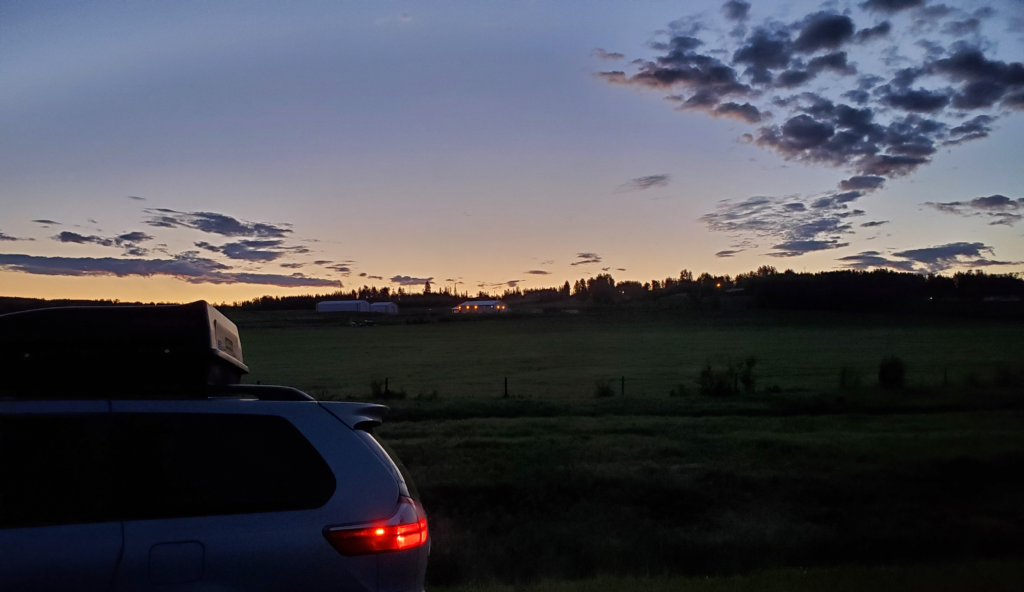
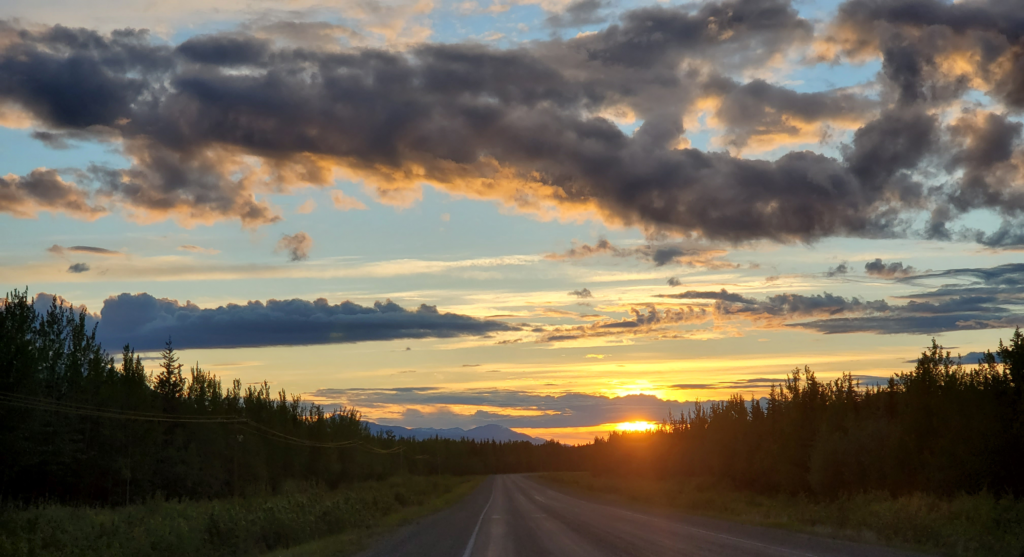
About 3 AM, I wake up, unplug my laptop from the car wash building and continue beyond Fort Nelson. I decide to push on through the night to Liard River Hot Springs, in the old days my favorite stop along the Alaska Highway, and take an early morning bath, badly needed after 5 days and 3,500 miles of hard driving. This far north and this close to summer solstice, of course, there is no darkness, just a substantial twilight during the 5 hours the sun dips below the horizon. Driving at night is thus not much different than driving during the day.
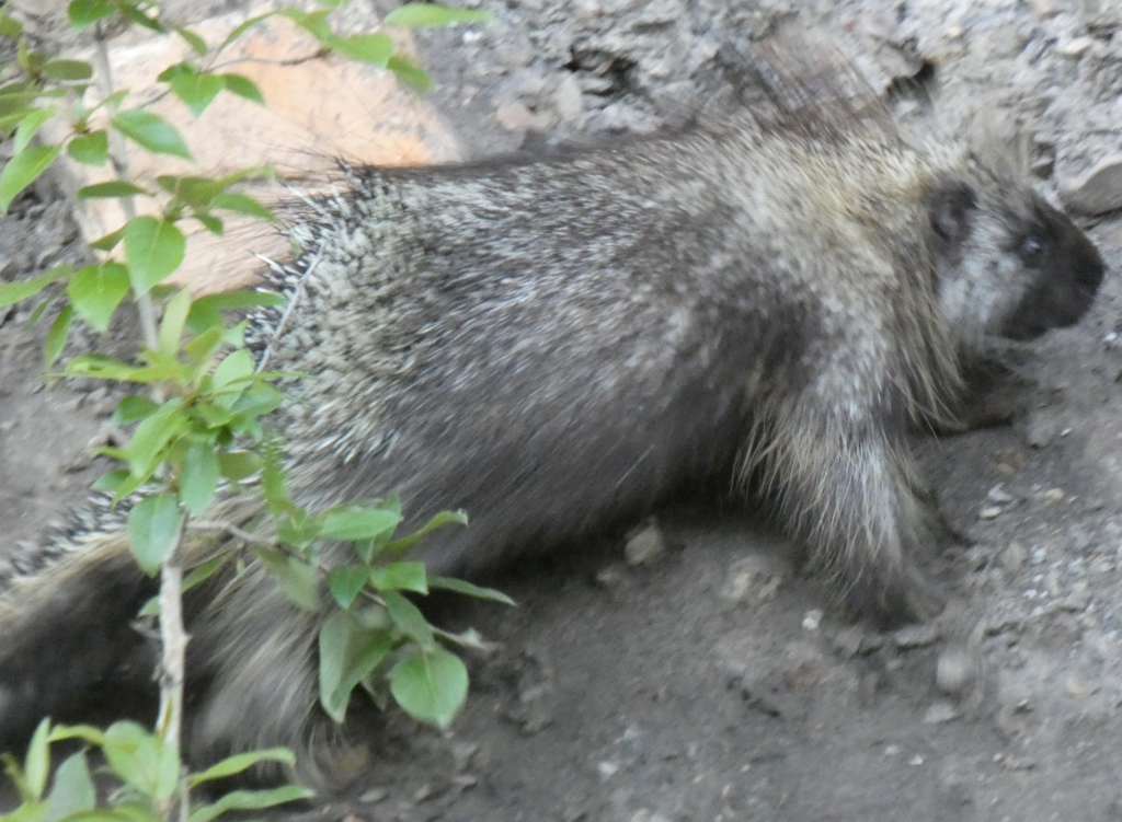
Taking advantage of the sparse traffic and roadside vegetation, wildlife of all sorts is foraging near the pavement. In the course of the night, I get closeup views of elk, caribou, moose, porcupine, and even stone sheep which typically frequent steep, alpine slopes. Few are particularly interested in the fact that I’ve stopped a few feet away to ogle them.
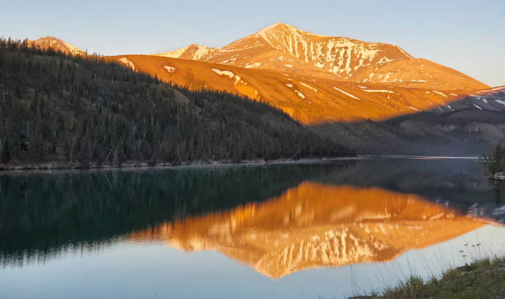
The highway is now crossing the Rocky Mountains, which are petering out this far north. They’re a far cry from the high peaks of Banff and Jasper to the south but still rugged and especially dramatic in the low light.
There’s no serious climbing and after two hours I reach the uninspiringly named Summit Pass. At 4,100 feet, this is the highest point of my trip to date.
Despite having very high, rugged mountain ranges, Canada and Alaska do not have the sort of dizzying roads found in the Andes and Himalayas. The highest I can get by car in Alaska is only 4,700 feet at Atigun Pass in the far northern Brooks Range, which I plan to do in a few weeks. Currently, even in midsummer, at 59 degrees latitude, Summit Pass’ modest altitude is not very summery. There are substantial patches of snow not far above the road.
As planned, I arrive at Liard River at opening time. The hot springs were made accessible by the US Army in 1942 during highway construction and although the area was made into a park in 1957, when I was last there in 1977, there were no controls or facilities beyond a rough boardwalk from the road to the hot pools. Now it’s much more civilized, with campsites, changing rooms, and a modest day use fee. Unfortunately, the springs have also had some tragic episodes. In 1997, a female tourist was killed by a bear right on the boardwalk in front of her two children. Several samaritans trying to save her, including her young son, were also mauled, one fatally, before the bear was shot. After this incident, the more remote, lower pool was closed for years. This year, the park has been enclosed with an electric fence to minimize human interaction with wildlife.
Today, I pull up to the booth, where a very friendly young woman delivers an unexpected blow: I’m not allowed in because, due to Covid, the park is restricted to British Columbia residents. Although the parking lot is empty at this time of day, she cannot make an exception. Even residents of adjacent Alberta and the Yukon are being turned away which must lead to some angry scenes. Thwarted, I park on the highway shoulder and sleep for a while until the hot sun forces me to wake up and get moving again.
A small sign leads me down a side road to a view of the impressive Smith River Falls. I’m tempted to walk the half mile trail to the base of the falls but decide to forgo it. I’ve warned people for years about solo hiking, where a mishap that would be trivial with a companion can be fatal when you’re alone. Social animal that I am, I almost always hike with others, sometimes shepherding a group of novices up a trail. It’s just more fun for me to share experiences. Now I’m solo in bear country and I start hearing my own advice in my head. Plus, a sign clearly informs hikers that the last portion is a steep slope that used to have stairs which burned up in 2008 and as of 2012 have not been replaced. The thought of a difficult down and up scramble reinforces my inclination that a closer view of the falls isn’t worth the risk, so I drive back out to the highway.
Just a few miles further, I encounter a herd of over 100 bison grazing both shoulders and blocking the traffic lanes. After watching these impressive but potentially dangerous creatures for several minutes, I edge the car through the herd and continue.
Not long after, I stop at Coal River Lodge for gas and internet. Much of the Alaska Highway is off the electrical grid and the lodge runs on its own generator. Without power lines, there are also no cell towers for these long stretches. With the highway devoid of tourists for 15 months and counting, many travel-dependent businesses have gone dormant or belly up.
Ordering pie and coffee for breakfast, I ask about using their internet. Apologetically, they say they have it but an overnight guest used up almost all of the monthly data allowance. To avoid an expensive surcharge for more data, they have to save what little is left for credit card transactions and phone calls. While dawdling over breakfast, I have some lively conversation with the staff, three Utah Mormons who hired on to run the lodge during the summer for its American owner.
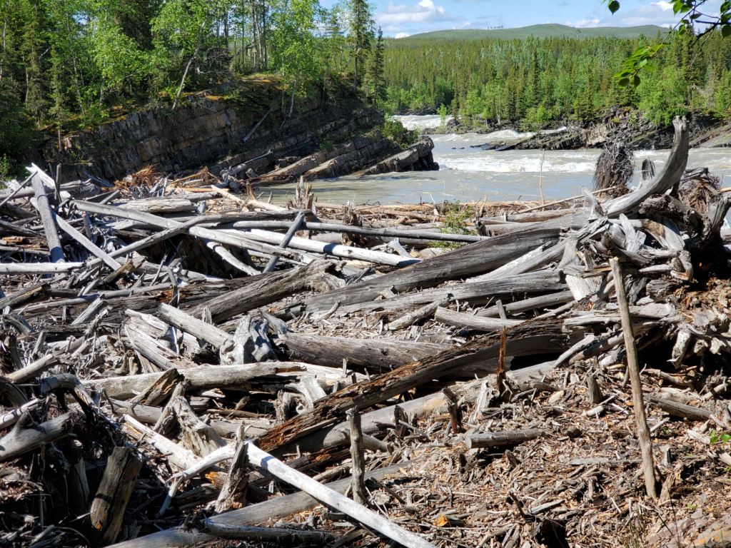
I also banter with a local truck driver, who lives here year round, and he recommends a scenic viewpoint along the way and tells some colorful stories about delivering fuel along the highway in mid-winter. Since my progress through Canada is substantially faster than my 4-day time limit, I’ve had time yesterday and today for stops and short side trips. Leaving the lodge, I follow a sign for Whirlpool Canyon into a pleasant riverside campground, where a sharp, narrow bend of the river creates a powerful eddy in a rocky corner. During floods, the water throws piles of trees up onto the shore. There’s quite a jumble of dead wood there. It’s an interesting spot and I spend a few minutes sitting in a random chair enjoying the scenery.
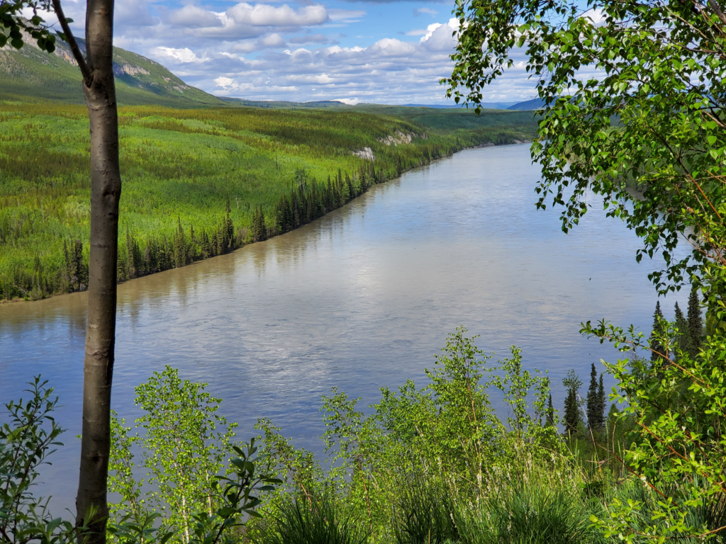
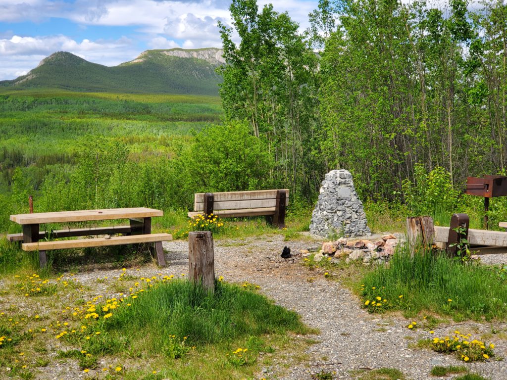
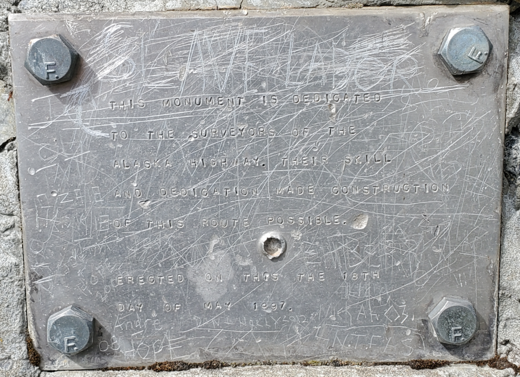
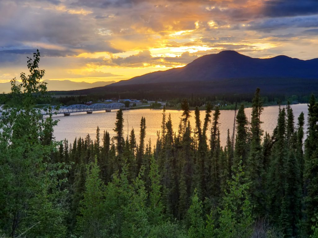
The next stop is the place the truck driver mentioned. Indeed, it is a beautiful observation point above a bend in the Liard River looking up and downstream, with picnic table, bench, and a stone monument to the 1942 Alaska Highway surveyors.
Cleverly, the plaque is produced with the same hand stamped letters used to label individual survey markers.
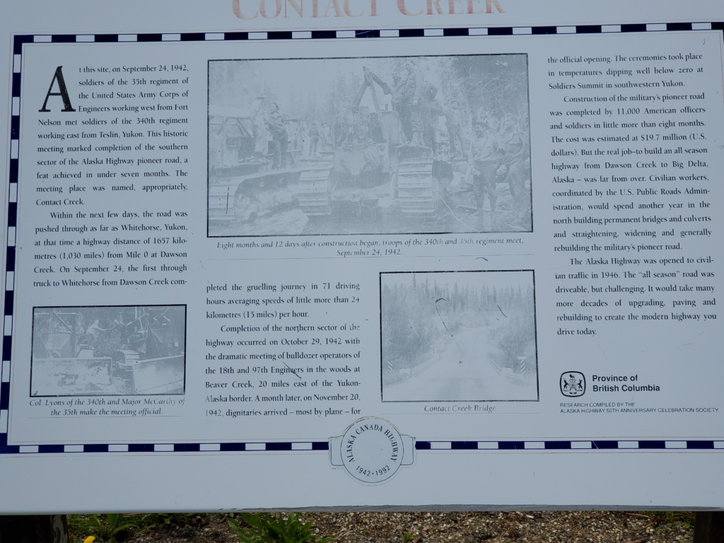
I’m almost out of British Columbia now and I stop at Contact Creek where a historical sign denotes the point where Army crews working up from Fort Nelson met their counterparts working down from Whitehorse, both racing to get the first, primitive version of the road completed. The sign reminds me again of how monumental and unprecedented a task was planned and executed in just a year.
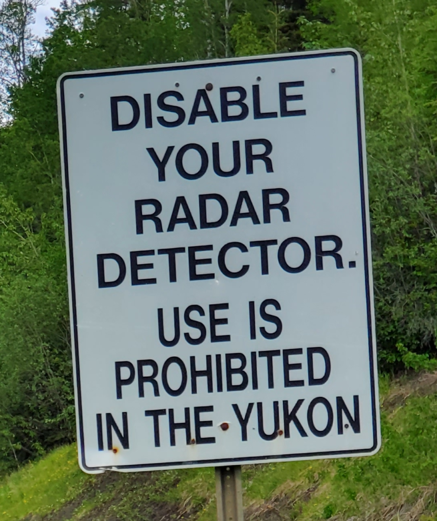
Another 45 minutes brings me to the Yukon Territory border. A series of signs seem to imply the Yukon motto is, “Forget lax British Columbia. There’s a new sheriff in town.”
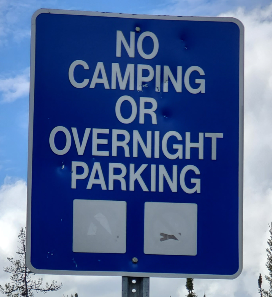
Yukon welcome signs
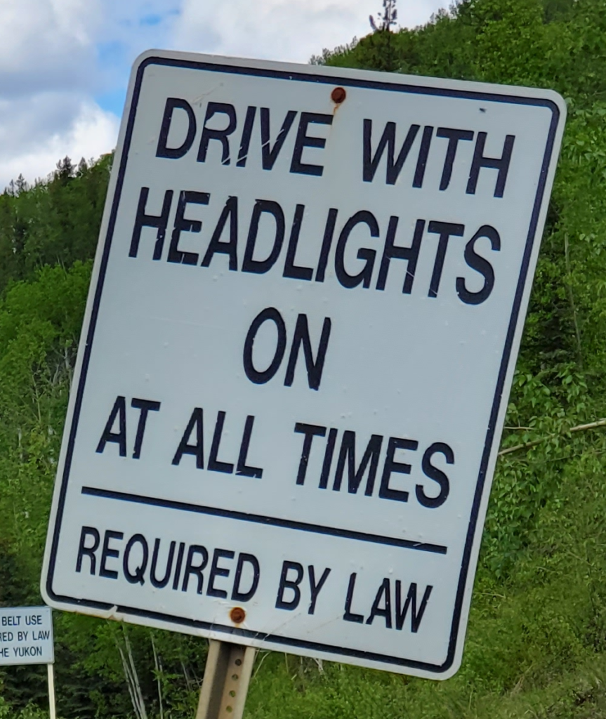
At the Watson Lake weigh station just across the border, all drivers must fill out Covid forms and receive instructions. The Yukon has more stringent requirement than other provinces. You get 24 hours to drive the 560 miles of Alaska Highway across the territory. You must use only services directly on the road and not leave it. No side trips, no entry into villages, no entry into downtown Whitehorse, and no entry into provincial parks, which eliminates all public campgrounds. I’m startled to see an instruction on the form exempting vaccinated travelers from the isolation requirements but when I ask the official about it he informs me it only applies to Canadians — my momentary hopes are dashed.
I’m not particularly low on fuel yet, so I proceed about 15 miles, reconsider the remote stretch immediately ahead and backtrack to Watson Lake to gas up and buy some juice before continuing. The 24 hour exit requirement means I can’t really enjoy much except the views from the road.
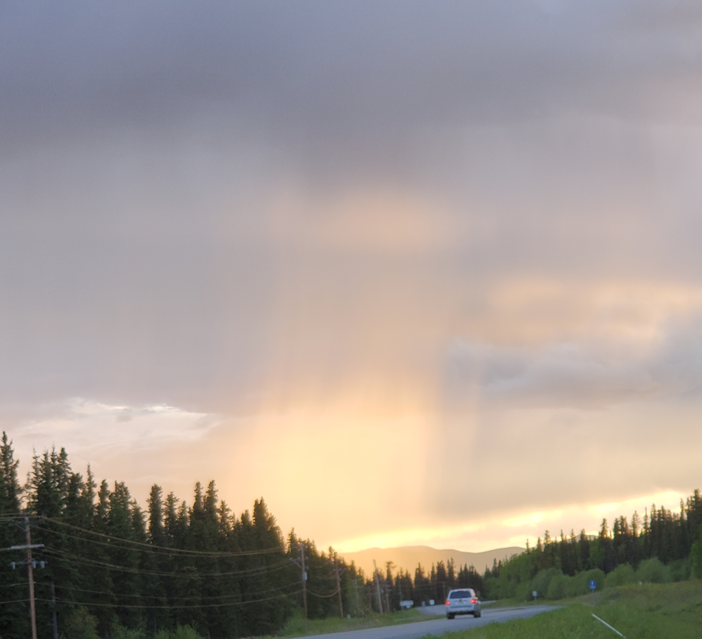
Fifty miles further on, getting tired, I pass a very tempting campground along a little lake. But there’s a big reminder sign right at the entrance, “Off limits for transit travelers,” so I pull off on a little spur road that goes down to the Rancheria River and take a nap there. An hour or so later, feeling refreshed, I continue another 160 miles to a roadside pulloff opposite Squan Lake. There, around 11:30 PM with sunset finally approaching, I park in a group of trucks and crawl in the back to get a longer sleep, ready to start again in the morning.
Next post: http://blog.bucksvsbytes.com/2021/07/16/road-trip-21-06-14-alaska-at-last/